US Trade Map Depicts Jammu & Kashmir and Aksai Chin as Indian Territory in Interim Agreement Framework
In a significant development coinciding with the announcement of an interim trade agreement framework between New Delhi and Washington, a map released by the United States Trade Representative's (USTR) office has drawn considerable attention. The map, shared on Saturday alongside details of the trade deal, portrays the entire Jammu and Kashmir region, including Pakistan-occupied Kashmir (PoK), as an integral part of India. Furthermore, it depicts Aksai Chin, a territory claimed by China, within Indian borders.
Notable Departure from Previous US Government Maps
While India has consistently maintained that Jammu and Kashmir is an inseparable part of its sovereign territory, the USTR's depiction marks a clear departure from earlier US government maps. Historically, such maps have often shown alternative claims or presented the region with disputed boundaries. This new representation provides a form of external validation that aligns with India's longstanding position, though Indian officials have traditionally stated that such validation is not required for its sovereignty.
The timing of this map release is particularly noteworthy, as it comes during a period of improving trade relations between India and the United States. This follows months of speculation and trade tensions, including earlier this year when the Trump administration imposed substantial tariffs on Indian goods. Notably, a 50% tariff was levied, with an additional 25% for Russian oil imports, which represented the highest tariffs imposed on a US ally at the time.

Key Provisions of the Interim Trade Agreement
Under the newly announced interim framework, these punitive tariffs are set to be significantly reduced. The agreement stipulates a reduction to 18%, which would position India among the Asian countries with the lowest tariff rates from the United States. The interim trade pact, expected to be formally signed by mid-March, aims to ease longstanding trade tensions and provide much-needed relief to Indian exporters after months of economic uncertainty.
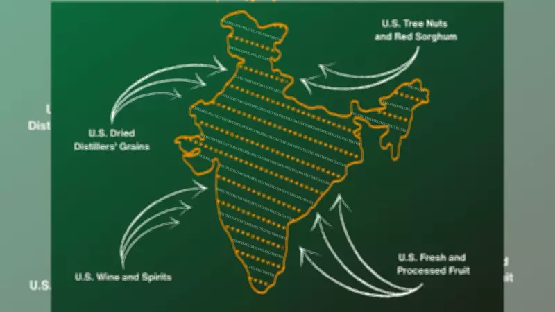
In a post on social media platform X, the US Trade Representative highlighted the benefits of the agreement for American products, stating: "From tree nuts and dried distillers' grains to red sorghum and fresh and processed fruit, the US-India Agreement will provide new market access for American products."
Aksai Chin Representation and Regional Implications
The map's inclusion of Aksai Chin as part of Indian territory adds another layer of geopolitical significance. Located in eastern Ladakh, Aksai Chin has been claimed by China, and this territorial dispute has remained a sensitive issue in bilateral relations between New Delhi and Beijing. The US map's depiction directly contradicts China's claims, potentially influencing regional dynamics.
Signal to Islamabad Amid Diplomatic Outreach
Though the USTR office has not issued any specific commentary regarding the map, its release presents an embarrassment for Pakistan, which claims sovereignty over PoK. This development occurs amid sustained diplomatic efforts by Pakistan to strengthen ties with Washington in recent months. These efforts have included multiple visits by Pakistan's Prime Minister Shehbaz Sharif and Army Chief Asim Munir, along with meetings with President Trump.
The interim trade agreement framework represents a strategic move to bolster economic cooperation between two of the world's largest democracies. As both nations work to finalize the details by mid-March, the accompanying map has added an unexpected dimension to the diplomatic and trade discussions, highlighting how cartography can reflect and influence international relations in subtle yet powerful ways.