Trichy's Comprehensive Master Plan Unveiled for 2046, Emphasizing Climate Adaptation
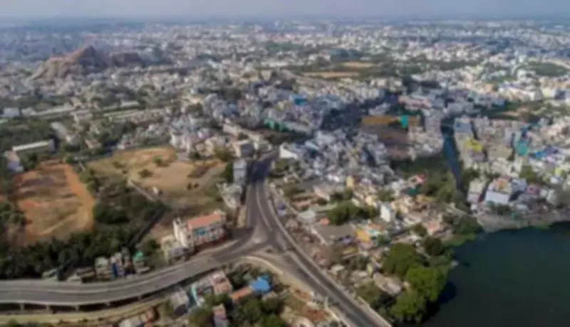
The Directorate of Town and Country Planning (DTCP) has officially launched the master plan for the Trichy Local Planning Area (LPA), covering an extensive 804.5 square kilometers. This strategic blueprint, developed after a 15-year gap, projects forward to 2045-46, addressing both urban growth and pressing environmental challenges. The plan encompasses Trichy corporation limits, two municipalities, four town panchayats, and 104 revenue villages, aiming to guide sustainable development in the region.
Climate Projections and Mitigation Strategies
According to the document, Trichy LPA may experience a significant increase in maximum temperatures by 0.7 to 0.9 degrees Celsius over the coming decades. Additionally, climate projections for 2046 indicate a 6.3% rise in extreme rainfall events, heightening risks of flooding and heat stress. To combat these issues, the plan proposes innovative solutions such as urban forests spanning approximately 113 acres, which could reduce local temperatures by 1-3 degrees Celsius. Riparian buffers of 50 meters along the Cauvery and Kollidam rivers, and 15 meters along the Aiyar and Koraiyar rivers, are recommended to mitigate flood impacts and enhance climate resilience.
Urban Development and Land Use Trends
The LPA accounts for 18.2% of Trichy district's area and houses 52.6% of its population, including Trichy city, Thuvakudi and Lalgudi municipalities, Koothappar, Poovalur, Manachanallur, and S Kannanur town panchayats, along with 91 village panchayats. A comparison between the 2011 and 2025 master plans reveals that residential land use has not expanded significantly, but commercial land use has surged, particularly along arterial roads. Residential development is increasingly concentrated on the outer peripheries of the LPA, where Trichy corporation is poised for expansion.

Dispersed urban development characterizes Trichy compared to other mid-sized cities, with limited vegetation cover, high built-up density, and impervious surfaces contributing to elevated surface temperatures, flood risks, and reduced groundwater levels. Notably, only 28% of wards, such as Rockfort, Srirangam, and Big Bazaar streets, exhibit extremely high population density.
Heritage and Tourism Potential
The master plan highlights opportunities to leverage Trichy's rich heritage for economic growth through tourism. It recommends developing tourist trails and circuits under a public-private partnership model, in collaboration with NGOs. Suggested trails include Srirangam and Thiruvanaikoil temple routes, heritage churches, and Islamic heritage paths. Despite Srirangam's tentative UNESCO listing, the plan notes that many aspects of the district's history remain under-promoted and overlooked by international tourists.
Expert Insights and Future Directions
Urban planner Kapilan Chandranesan, based in Trichy, commented that while urban forests and sponge parks are steps in the right direction, they may be insufficient to tackle heat stress effectively. He advocated for the LPA to develop landbanks with necessary infrastructure to ensure balanced growth, especially given rising land prices. Trichy corporation sources added that efforts are underway to focus on urban forestry improvements and redevelop tanks to combat climate change risks, aligning with the plan's long-term vision for mobility, balanced development, and heritage conservation.