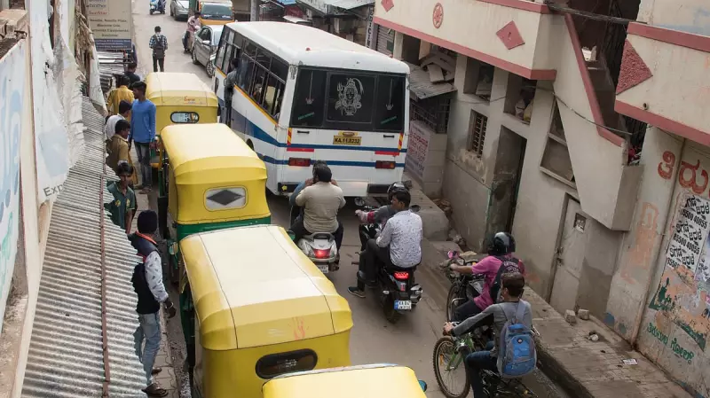
Residents of Bengaluru are facing an unexpected consequence of modern technology as popular navigation applications are turning quiet residential lanes into congested traffic hotspots. The very tools designed to optimize travel routes are now creating chaos in the city's narrower inner roads.
The Algorithmic Traffic Dilemma
Navigation platforms like Google Maps, Waze, and other route optimization services are systematically diverting vehicles from main arterial roads onto smaller residential streets and lanes. These algorithms, while effective at calculating the fastest routes, completely disregard the physical capacity and infrastructure limitations of these smaller roads.
The problem has become particularly acute in Bengaluru, where the issue was highlighted in reports dated 11 November 2025. As these apps gain more users, the volume of traffic being redirected through unsuitable routes continues to increase dramatically.

Local Residents Voice Concerns
Bengaluru citizens are growing increasingly frustrated with the situation. The constant stream of vehicles through previously quiet neighborhoods has raised serious safety concerns, especially for children and elderly residents. The narrow lanes, never designed to handle such traffic volumes, are experiencing unprecedented wear and tear.
Local communities have begun organizing and voicing their demands for a technological solution. There is a growing consensus that navigation apps must integrate with the city's traffic management systems to account for road capacity, infrastructure limitations, and residential concerns when calculating routes.
Seeking Sustainable Solutions
The core of the problem lies in the disconnect between digital mapping technology and physical urban infrastructure. While navigation apps excel at calculating distance and time, they lack awareness of road width, structural capacity, and the social impact of routing heavy traffic through residential areas.
Urban planning experts suggest that a collaborative approach between technology companies and municipal authorities could provide the answer. Integration with city traffic systems would allow navigation apps to access real-time data about road conditions, construction projects, and capacity limitations, creating smarter routing that benefits both drivers and residents.
As Bengaluru continues to grapple with its notorious traffic challenges, the conversation around responsible navigation technology has taken center stage. The city's experience serves as a cautionary tale for urban centers worldwide about the unintended consequences of technology-driven solutions operating in isolation from ground realities.