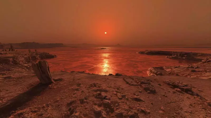
Scientists Map Ancient Arctic-Sized Ocean on Mars Using New Evidence
For decades, Mars has been portrayed as a dry and barren world, stripped of familiar features. Yet beneath its dusty surface, a quieter and older story has been waiting to emerge. A new study now brings together compelling pieces of evidence, painting a clearer picture of the Red Planet's watery past.
From Speculation to Solid Shapes
Previous claims about Martian oceans often relied on broad theories and topographic models. The latest research takes a different approach. It focuses on specific geological features that resemble river deltas on Earth. These structures were found far from the northern plains where scientists once imagined ancient seas.
Instead of working from general assumptions, the team examined shapes, edges, and sediment patterns. The result feels less speculative and more grounded in observable facts. Mars, the study suggests, once hosted a stable body of water large enough to shape coastlines and maintain them over extended periods.

Liquid water remains central to Mars research because it fundamentally changes what the planet might have been. Water allows chemistry to develop gradually rather than in sudden bursts. It sculpts landscapes slowly and deliberately. Earlier missions detected signs of rivers and lakes, but these often appeared short-lived or localized. What was missing was firm evidence of a long-standing ocean with a defined boundary.
Surprising Location Near the Equator
The team identified these delta-like structures in Coprates Chasma, part of the vast Valles Marineris canyon system near the Martian equator. This location surprised researchers. Oceans were typically placed in the northern lowlands, not connected to deep canyon walls.
Using detailed imagery, scientists mapped fan-shaped deposits along slopes that look remarkably like river mouths on Earth. These deposits sit against scarps in a manner that implies water once flowed into a larger body rather than simply spreading across the land. The shapes appear ordered and repeat across the area, suggesting consistent processes rather than random events.
Narrow Scope, Firmer Details
The new study is narrower in scope but firmer in detail compared to earlier work. The delta-like features match Earth examples not just in outline but in internal structure. They show layered sediment and consistent angles that point to sustained water activity.
Professor Fritz Schlunegger of the University of Bern emphasized that these are not ambiguous forms. He described them as clear signs of rivers entering an ocean. This confidence comes from direct comparison with terrestrial processes rather than theoretical modeling. Researchers examined how water behaves on Earth and asked whether Mars displayed the same logical patterns.
Imaging Technology Reveals Hidden Patterns
The research relied on high-resolution color images from the CaSSIS camera aboard ESA's ExoMars Trace Gas Orbiter. Developed at the University of Bern, CaSSIS has been operating since 2018. It allows scientists to see surface details at a scale previously impossible.
These images were combined with data from Mars Express and the Mars Reconnaissance Orbiter. Professor Nicolas Thomas, who led the camera's development, expressed satisfaction that the imagery is now used for geological interpretation beyond mere surface description. The technology enabled the team to trace shoreline patterns across extensive areas.
An Ocean Comparable to Earth's Arctic
Based on reconstructed coastlines, researchers estimate the ocean covered an area similar in size to Earth's Arctic Ocean. It would have spread across much of Mars' northern hemisphere. This is not a claim of constant depth or uniform conditions. Instead, it suggests a stable sea that lasted long enough to accept sediment and maintain a clear boundary.
Wind erosion and dust storms later reshaped the surface, but the core forms remain intact. Dunes now cover many of the deposits, though their original structure is still visible beneath.

What Comes Next in Martian Research
The team plans to study the mineral content of ancient sediments. Minerals can preserve traces of water chemistry and environmental conditions. For doctoral researcher Ignatius Argadestya, who led the mapping effort, the work feels familiar in an unexpected way. He noted how closely Martian valleys resemble landscapes on Earth once shaped by water.
The study does not close the case on Mars' oceans. Instead, it opens another layer of investigation—one that feels less dramatic but harder to ignore. While it doesn't directly answer questions about past life, it narrows the gap by showing Mars had conditions that endured rather than flashed briefly into existence.
This research shifts our understanding from a dry, stripped planet to one that once held vast, stable waters. The evidence now points to a Martian past where oceans shaped coastlines and rivers flowed into seas, much like on our own world.