IRNSS-1F Satellite Achieves 10-Year Mission Milestone for India's NavIC System
Imagine a satellite orbiting Earth in complete silence for an entire decade, diligently transmitting precise location data to millions of users on the ground. This is the story of IRNSS-1F, one of India's key navigation satellites, which celebrated the completion of its 10-year design mission life on March 10, 2026. This event represents a significant achievement for the Indian Regional Navigation Satellite System (NavIC), underscoring the nation's strides in self-reliant space technology.
Launch and Initial Deployment
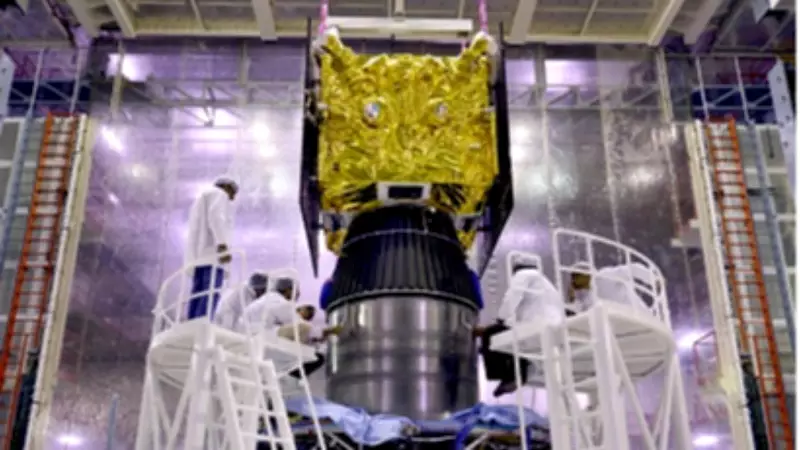
The Indian Space Research Organisation (ISRO) launched IRNSS-1F on March 10, 2016, aboard the PSLV-C32 rocket from Sriharikota. As the sixth satellite in the NavIC constellation, it joined five earlier satellites to form the core of India's regional navigation network. Weighing 1,425 kilograms, the satellite was positioned in a geostationary orbit at 32.5° East with a 5° inclination, engineered to provide reliable service for over a decade.
Key payloads included:

- A navigation transmitter operating in the L5 and S-bands for signal transmission.
- A C-band transponder for precise ranging, supported by corner cube retroreflectors for laser ranging.
Following launch, ISRO's Master Control Facility in Hassan assumed control, deploying the solar panels flawlessly within 19 minutes. This setup enabled NavIC to offer an independent alternative to the Global Positioning System (GPS), with coverage extending 1,500 kilometers beyond India's borders for applications like vehicle tracking.
Mission Life Triumph and Atomic Clock Challenges
On March 13, 2026, ISRO officially announced that IRNSS-1F had completed its 10-year design mission life as of March 10, 2026. Notably, the onboard rubidium atomic clock ceased functioning on March 13, 2026. Despite this setback, the satellite continues to operate by sending one-way broadcast messages, maintaining its utility for societal applications.
The atomic clocks, critical for timing accuracy, faced early issues with two failing before the mission's end, leaving the satellite reliant on a single clock's resilience. Nevertheless, IRNSS-1F exceeded expectations, demonstrating the robustness of the IRNSS design. Specifications from the U R Rao Satellite Centre had projected a mission life exceeding 10 years, a claim validated by this endurance.
This longevity highlights ISRO's advancements in clock technology, with upgrades incorporated into subsequent NVS satellites to future-proof the NavIC constellation.
Applications and Future Impact
IRNSS-1F has played a pivotal role in various real-world scenarios, including:
- Providing accurate time for mobile navigation and fishing advisories at sea.
- Enhancing highway safety through vehicle tracking and fleet management.
- Supporting disaster response efforts and strategic autonomy initiatives.
In its post-mission phase, the satellite's one-way messaging capability extends its usefulness even without full navigation functions. NavIC offers a regional advantage over GPS with dual-frequency capabilities, better suited to India's challenging terrain.
Looking forward, the deployment of NVS satellites aims to strengthen the constellation and align with global standards. IRNSS-1F's successful run also fuels ambitions for missions like Gaganyaan, showcasing ISRO's cost-effective expertise. As noted in URSC documentation, such milestones "enhance regional navigation autonomy," closing one chapter while propelling NavIC's story forward as a testament to indigenous technological prowess.