
Cyclone Ditwah, which weakened into a deep depression on Tuesday, executed an unexpected U-turn over the Bay of Bengal before making landfall between Kalpakkam and Puducherry around midnight. The system, which lingered off the Chennai coast causing incessant rainfall, is predicted to weaken further into a depression and then into a well-marked low-pressure area.
Heavy Rainfall Forecast for Northern Districts
Despite the weakening, weather experts have forecast heavy rainfall in Chennai until Wednesday noon. The adjacent districts of Chengalpet, Kancheepuram, Vellore, and Tiruvannamalai are also expected to receive significant showers as the low-pressure area moves over them. The India Meteorological Department (IMD) has issued a warning for heavy rain in isolated areas over north coastal Tamil Nadu.
Private weather blogger Pradeep John explained that cloud formation is intensifying over Tiruvallur and North Chennai. "Chances of rain in Chennai and other districts cannot be ruled out as long as there is circulation in the system," he stated.

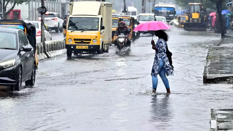
Record Rainfall Lashes the City
Tuesday morning saw intense spells of rain across Chennai and its suburbs, continuing the wet trend from Monday. Key 24-hour rainfall figures until 8:30 am on Tuesday were notably high:
- Ennore, Parry’s Corner, Ice House, and New Manali Town all recorded rainfall crossing 20 centimeters.
- Areas like Perambur, Vadapalani, and Nungambakkam received rainfall just a few millimeters short of the 20cm mark.
Subsequent data until 5:30 pm showed Ennore receiving an additional 2.5 cm, Nungambakkam 1.5 cm, and Meenambakkam 1 cm of rain.
Why the Cyclone Changed Course
Pradeep John provided insight into the system's unusual south-westward movement. He said that once Cyclone Ditwah weakened into a depression, it could no longer withstand the force of the low-level winds blowing from the northeast. These winds effectively pushed the system southwards.
"If it had sustained as Cyclone Ditwah with a clear eye in the middle, it would have moved forward, taking the winds in its stride," John explained. He added that the current trajectory is beneficial for Chennai, as the northern bands of the system, which contain rain clouds, are cast over the city. Had the system moved north, Chennai might have missed Tuesday's rainfall.
As of 5:30 pm on Tuesday, the IMD reported the centre of the depression was just 25 km from the coast, positioned about 80 km southeast of Chennai. The system's slow movement at approximately 3 km per hour helped maintain its potency, allowing for continued cloud formation.
The city now braces for further weather developments as the system continues to influence regional conditions.


