Goa's Chorao Bridge Project: A Rs 275 Crore Dream Divides Locals Over Ecological Costs
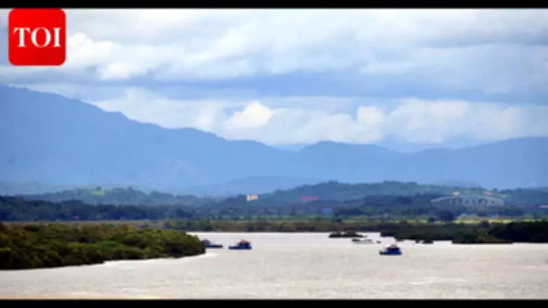
In the heart of Goa, a long-awaited infrastructure project is sparking a fierce debate between progress and preservation. The proposed bridge connecting Chorao, Goa's largest riverine island, to Salvador do Mundo represents a Rs 274.8 crore vision for improved connectivity, but it is simultaneously raising alarm bells over potential ecological devastation.
A Three-Decade-Old Proposal Gains Momentum
The concept of a bridge through Salvador do Mundo or Ribandar has been discussed for over thirty years. For generations, ferryboats have served as the primary link for islanders traveling to Ribandar and Pomburpa, inadvertently preserving the area's pristine status. Now, the Goa State Infrastructure Development Corporation (GSIDC) has reignited the plan by inviting bids to complete the project within three years—a significant escalation from the initial Rs 141 crore tender floated in late 2013.
"The proposed bridge is expected to significantly improve connectivity for Chorao residents and surrounding areas while also boosting local development," stated a GSIDC official, highlighting the project's anticipated benefits. Local MLA Premendra Shet echoed this sentiment, asserting that the government has secured public consent and describing the bridge as "the islanders' long-time dream for better connectivity to Panaji."

Residents Demand Transparency and Voice Environmental Fears
Despite official optimism, residents of Salvador do Mundo have called for greater transparency during a gram sabha meeting. The project details, revealed in a July 23, 2024, assembly reply to Mandrem MLA Jit Arolkar, outline a 425-meter steel bridge with two substantial embankments: 234 meters in Chorao and 429 meters in Saloi as approaches.
These embankments are slated to traverse ecologically fragile zones on both sides, including poims—critical waterbodies within the ancient khazan system that regulate floodwaters. This area, renowned as one of Bardez's most fertile patches, is a vital habitat for otters, diverse avian species, and fish nurseries.
"The rain water flows in the north-south direction from hills and the huge east-west embankment may disrupt flow to Mandovi river even if pipes are used," warned Dinesh Dias, a farmland owner and activist. He expressed concerns that massive water displacement in the Salvador do Mundo khazan—a balancing reservoir during monsoons—could adversely affect the cultivated stretch from Quitula to Ecoxim due to landfilling.
Khazan Ecosystem and Flood Vulnerability at Stake
Activists emphasize that protecting khazan land is essential for flood control, agriculture, and the very survival of the island. "Khazan land protection is vital for flood control, agriculture and island survival. Sluice gates, poims and bundhs act as tidal regulators," explained Eusebio D'Silva of Save Chorao.
In a 10-point charter, residents have demanded that Chorao be declared an ecologically sensitive island. Others are advocating for the bridge site's relocation to mitigate impacts on local flora and fauna. Vikas Prabhudesai, a Porvorim resident, cautioned, "There could be increased flooding in agricultural fields, harm to local farmers' livelihoods, and long-term environmental damage."
Climate Change and Rising Sea Levels Add Urgency to Concerns
The project's location near vulnerability-indexed areas like Merces—heavily devastated by past reclamation—amplifies these fears. The State Action Plan for Climate Change, prepared by Nabard consultancy services (Nabcons) for Goa, identifies Tiswadi, Bardez, and Salcete as highly vulnerable to flooding due to sea-level rise, with altitudes within 5 meters.
Environmental architect Elsa Fernandes underscored the need for caution: "The water level keeps rising and we need to be cautious about any projects that involve massive reclamation, involving water level impacts." Her recent geo-spatial study, utilizing spectral satellite imagery and ISRO's Digital Elevation Modelling data, reveals that areas like Merces are at a critically vulnerable altitude of less than 2 meters.

Fernandes noted that out of Tiswadi taluka's 98 square kilometers of low-lying khazans, 70% fall within a perilous 2-3 meter elevation range. Many patches near Panaji's Patto and KTC bus stand, as well as St Cruz, are already submerged, aligning with ISRO projections that areas near Panaji could be underwater by 2050.
Infrastructure Challenges and Calls for Independent Assessment
The bridge project also faces practical infrastructure hurdles. It will link to narrow roads in Penha da Franca and Salvador do Mundo, flanked by houses and compounds, potentially channeling traffic from Bicholim into Porvorim. Additionally, trucks sourcing mud for the 7.5-meter carriageway risk destroying adjacent fields.
Past projects, like a bridge over the Chimbel river in Merces khazan, have buried parts of eco-fragile flood plains for service roads without adequate impact sensitivity or climate-proofing measures. Reflecting on these precedents, D'Silva insisted, "An independent and legally compliant assessment of the project's social, environmental and infrastructural impact on Chorao is in order."
As Goa stands at a crossroads, the Chorao bridge project encapsulates a broader dilemma: balancing developmental aspirations with the imperative to safeguard fragile ecosystems and mitigate climate risks. The coming months will determine whether this infrastructure dream can harmonize with environmental realities or if ecological concerns will reshape its trajectory.