
The city of Hyderabad experienced a meteorological rollercoaster throughout the month of November, with residents witnessing dramatic shifts from torrential rains to biting cold within a matter of weeks. This pattern of extreme weather events, scientists warn, is a sign of things to come, driven largely by climate change and rapid urban development.
From Cyclonic Fury to Chilling Lows
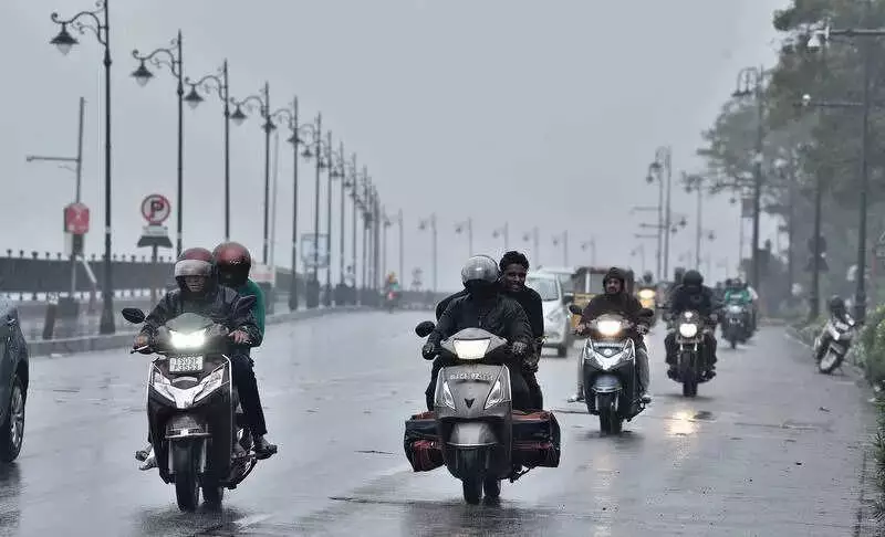
The month began under the severe impact of Cyclone Montha, which caused widespread disruption across Telangana. Several districts were inundated, recording an astonishing single-day rainfall exceeding 500 mm. The cyclone's intensity set a dire tone for the month's weather narrative.
As the cyclone's clouds cleared, they were swiftly replaced by a starkly different phenomenon. A two-week-long cold wave gripped the city, pushing temperatures down to their lowest point in the past seven years. The sudden dip left citizens scrambling for warm clothing and raised concerns about public health.

The final week of November delivered yet another twist. Daytime temperatures in some areas climbed to around 30°C, offering a brief, warm reprieve. However, nights told a different story, with mercury levels plunging to single-digit figures, highlighting the extreme diurnal variation.
The Science Behind the Swings
Meteorologists point to a confluence of factors for these sharp fluctuations. YV Rama Rao, a senior meteorologist from the Telangana Development and Planning Society (TDPS), identifies the primary driver. "Rising sea surface temperatures in the Bay of Bengal remain the biggest driver of these extremes," he states. "Even a half-degree rise in Bay of Bengal temperatures can significantly energise cyclonic systems. Cyclone Montha is a recent example of how warmer waters translate into heavier rainfall over Telangana."
He further explains that a warmer atmosphere retains more moisture, leading to high-intensity rainfall episodes following major weather disturbances.
The unexpected cold wave also has a cyclonic connection. Mahesh Palawat, a meteorologist from Skymet Weather, clarifies this link. "Cyclones pull large amounts of warm, moist air toward their centre, causing a sudden retreat of moisture and creating clear skies after they pass. These clear, dry conditions allow heat to escape rapidly at night, leading to sharp drops in temperature," he said. Palawat predicts that while temperatures will fall again soon, the severe winter is likely to be felt in the second half of December.
A Warning for the Future
Experts unanimously warn that such erratic weather is not an anomaly but a preview of a changing climate. Professor Anjal Prakash, Clinical Associate Professor (Research) and Research Director at the Bharti Institute of Public Policy, Indian School of Business, presents a concerning forecast for Telangana.
He projects:
- Increased erratic rainfall patterns, with projections of 1.8% to 64.5% higher rainfall.
- More intense cyclones due to ongoing sea warming, with a predicted 0.5°C to 1°C rise in sea temperatures.
- Greater temperature anomalies, potentially up to 3.3°C by 2050.
"Warmer winters, extended rainy seasons into October, and amplified swings from climate phenomena such as La Niña are likely," Professor Prakash cautions, "exacerbating risks without decisive action." The combined forces of warming seas, shifting atmospheric conditions, changing wind patterns, and rapid urbanization are creating a perfect storm for more frequent and severe weather extremes in the coming decade.
The November weather saga in Hyderabad serves as a stark, real-time case study, urging both adaptation and mitigation in the face of a rapidly changing climate.


