Tamil Nadu Embarks on Ambitious Blue Carbon Mapping Project
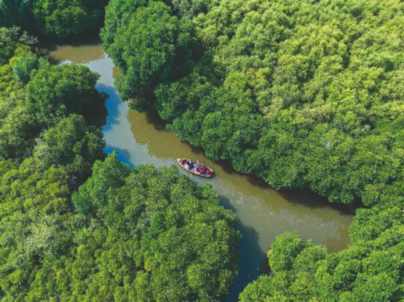
In a groundbreaking initiative to combat climate change and unlock economic potential, Tamil Nadu is launching a comprehensive high-resolution mapping project for its critical coastal ecosystems. The state is home to approximately 90 square kilometers of mangroves, 800 square kilometers of seagrass beds, and 64 square kilometers of tidal marshlands. However, these figures remain uncertain due to poor mapping and reliance on extrapolated field samples, with discrepancies between state and national assessments.
Precision Mapping for Carbon Market Integration
Experts emphasize that accurate estimates are crucial for trading carbon stored in these ecosystems on the global carbon market. To address this, city scientists are planning to undertake detailed mapping using advanced technologies. The project aims to generate pixel-level carbon data adhering to global standards and develop a Blue Carbon Atlas for Tamil Nadu.
"Mangroves store five times more carbon than terrestrial forests," explains R Nagarajan, head of GIS and remote sensing at the M S Swaminathan Research Foundation (MSSRF). The foundation is leading the project in collaboration with the Tamil Nadu forest department, with support from Microsoft.

"The project will provide us with the exact extent of mangrove spread. We will also map degraded lands to assess restoration potential, enabling the state government to invest in conservation efforts," adds Nagarajan.
Technological Innovations Driving the Project
Microsoft is contributing to algorithm development and cloud-based processing through its Azure platform, facilitating automated species classification and large-scale carbon estimation. The project will produce both digital and hard-copy versions of the Blue Carbon Atlas.
The mapping process involves several sophisticated techniques:
- Army-grade drones equipped with multispectral sensors will capture imagery at a resolution of 2cm to 5cm, significantly sharper than previous satellite-based mapping at 10m resolution. These sensors allow for detailed vegetation analysis.
- Light Detection and Ranging (LiDAR) measurements will determine canopy height, a key parameter for estimating forest biomass. The captured imagery will be processed to classify different mangrove species.
- Drone data will be integrated with satellite information to estimate both above-ground and below-ground biomass. Ground data from field sampling will validate drone observations.
- In the final imagery, each pixel will be assigned a specific carbon value, enabling precise carbon mapping and allowing scientists to quantify carbon stored in mangroves.
- Tidal marshlands alongside mangrove ecosystems will also be mapped as part of the study.
Challenges in Seagrass Mapping
Mapping seagrass presents additional challenges, as drones flown at 15m height can detect seagrass only up to 5m underwater, making deeper beds harder to map. Key regions such as the Gulf of Mannar and Palk Bay, which host extensive seagrass ecosystems and serve as habitats for dugongs under a designated conservation programme, will be covered under the project.
The Importance of Blue Carbon Ecosystems
Mangroves, seagrass meadows, and tidal marshes are among the most efficient natural systems for storing carbon, often referred to as blue carbon ecosystems. Mangroves protect coastlines from storms and erosion while serving as breeding and nursery grounds for fish, crabs, and prawns that support coastal livelihoods. Seagrass meadows stabilize sediments, improve water quality, and provide habitat for marine species such as dugongs and turtles. Tidal marshes trap sediments and store large amounts of carbon in their soils.
This initiative not only aims to provide precise data for carbon trading but also highlights the ecological and economic value of Tamil Nadu's coastal ecosystems, paving the way for enhanced conservation and sustainable development.