The island nation of Sri Lanka is grappling with the aftermath of Cyclone Ditwah, a storm that has caused widespread destruction and claimed hundreds of lives. Unlike typical cyclones that threaten the Indian subcontinent, Ditwah followed an unusual and devastating course, exposing Sri Lanka's comparative lack of preparedness for such intense weather events.
The Unusual Genesis and Path of a Destructive Storm
Cyclone Ditwah originated from a low-pressure system that developed in the southwest Bay of Bengal around November 25. This area in the north Indian Ocean basin is not a common breeding ground for cyclones. However, a rare convergence of two atmospheric conditions made its formation possible. An active Intertropical Convergence Zone, a belt of thunderstorms near the equator, interacted with a system of equatorial waves, providing the necessary fuel for the cyclone to emerge on November 27.
The system first developed southeast of Sri Lanka on November 26 and began a slow, northward crawl along the country's eastern coastline. Crucially, its track ran almost parallel to the coast rather than directing it inland. This meant the cyclone lingered over coastal waters for an extended period, allowing its massive rainbands to dump extreme rainfall on the island for days, with some areas recording up to 400 mm of rain in 24 hours.

Why Sri Lanka Was So Vulnerable
Several factors amplified the impact of Ditwah, which was officially classified only as a 'cyclonic storm'—the second weakest category. Mrutyunjay Mohapatra, Director General of the India Meteorological Department (IMD), noted that Sri Lanka historically experiences very few cyclones. Its location closer to the equator (between 5 and 10 degrees north latitude) means the Coriolis force—essential for cyclone spin—is weaker, making cyclone formation less frequent than in India.
Consequently, Sri Lanka lacks the elaborate disaster mitigation and large-scale evacuation mechanisms that India has developed over years of frequent cyclone landfalls. Despite the IMD's Regional Specialised Meteorological Centre (RSMC) issuing an alert for cyclogenesis as early as November 20 and sharing regular updates with Sri Lankan authorities, the country's capacity for mass evacuation was limited. The storm's slow movement, hilly terrain in the affected regions, and three consecutive days of torrential rain led to catastrophic landslides and coastal inundation.
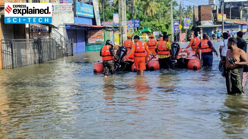
Aftermath and the Role of Early Warnings
The devastation highlights a critical gap between early warning and on-ground preparedness. The IMD, which serves as the regional hub for cyclone monitoring for countries including Sri Lanka, Bangladesh, and the Maldives, had predicted the formation of a depression as early as November 13. Detailed three-hourly and six-hourly updates were provided from November 23 onwards.
However, the geographical and infrastructural realities on Sri Lanka's eastern coast meant that even with advance knowledge, the damage was severe. The remnants of Cyclone Ditwah continued northwards, reaching about 40 km southeast of Chennai by noon on Tuesday, December 2. The system has since weakened into a depression and is expected to dissipate further after moving towards the north Tamil Nadu-Puducherry coasts.
This event serves as a stark reminder of the increasing climate volatility in the Indian Ocean region and underscores the need for enhanced regional cooperation and localized disaster response strategies, even for nations not traditionally in the direct path of major cyclones.