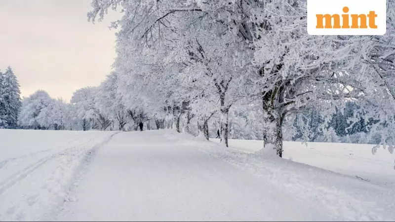
AccuWeather has issued a warning for a challenging week of winter weather across the northeastern United States. A sequence of three separate, fast-moving clipper storms is poised to deliver a messy mix of snow, sleet, and freezing rain to parts of New England and the mid-Atlantic region, with impacts stretching right through the upcoming weekend.
Three-Storm Assault: Timeline and Expected Impact
The region is preparing for a one-two-three punch from winter systems. The first storm is active through Tuesday evening, a second is expected around Christmas Eve into Christmas Day, and a third, potentially more powerful system is forecast from Friday into Saturday. While not every town will experience all three events, some areas could face repeated bouts of wintry precipitation, depending on the final paths these storms take.
Storm One: A Slippery Start on Tuesday
The initial clipper is currently moving across the Northeast, bringing light but hazardous snowfall to major travel corridors like Interstates 80, 81, and 87. New York City may see a light dusting, particularly north and west of Route 287. Boston could receive 1 to 3 inches of accumulation.
Higher totals of 1 to 6 inches are likely in northeastern Pennsylvania, northwestern New Jersey, upstate New York, and parts of northern New England. Southwestern Maine faces the risk of more than 6 inches of snow. Blustery conditions on Wednesday could lead to blowing and drifting snow across New England and northern New York.
Storm Two: A Christmas Eve Mix
The second system may split as it approaches. Northern New York and northern New England are likely to see snow, while areas farther south, including the Ohio Valley and sections of the mid-Atlantic coast, will probably deal with rain or drizzle. However, a tricky mix of snow, sleet, and ice is possible overnight Wednesday into Thursday in southern New York, northern New Jersey, and central Pennsylvania.
Storm Three: The Major Weekend Disruptor
Forecasters indicate the third storm could be the most significant. Tracking farther south and drawing in colder Arctic air, it is expected to bring accumulating snow from North Dakota through the Great Lakes, reaching the New York City metro area, New Jersey, and southern New England by Friday night.
AccuWeather predicts 3 to 6 inches of snow for New York City, Long Island, Connecticut, central New Jersey, and parts of Pennsylvania. The Catskill Mountains of New York and northeastern Pennsylvania could see a more substantial 6 to 12 inches. Cities like Philadelphia, Baltimore, and Washington, D.C., may encounter a wintry cocktail of snow, sleet, and freezing rain.
A serious concern is the potential for significant ice accumulation—up to a quarter of an inch—in south-central Michigan, Pennsylvania's Allegheny Mountains, and parts of West Virginia. This level of ice raises the threat of tree damage and widespread power outages.
Travel Chaos and Broader Weather Warnings
The storm series threatens major travel disruption during a busy holiday period. Key highways including I-80, I-81, I-84, I-87, I-90, I-94, and I-95 could be affected by snow and ice. Airports across the Northeast, such as those in New York, Boston, Philadelphia, and Washington, may experience delays and cancellations due to the weather and necessary deicing operations.
AccuWeather experts warn that even modest snowfall can cause major problems during the post-Christmas travel rush, especially when combined with icy road conditions. Meanwhile, the National Weather Service has also issued warnings for heavy rain and flash flooding in Southern California, while moderate to heavy snow continues in the Sierra Nevada and other parts of the Northeast.
Residents and travelers are strongly advised to monitor local forecasts closely and plan for potentially hazardous conditions throughout the holiday week.


