China's Extensive Ocean Mapping Program Targets Submarine Warfare Enhancement
China is executing a comprehensive ocean-mapping and monitoring initiative spanning the Pacific, Indian, and Arctic oceans. Naval experts assert that the data gathered could substantially improve China's submarine warfare capabilities against the United States and its allies. This effort utilizes dozens of research vessels and hundreds of underwater sensors, extending beyond mere scientific inquiry.
Dual-Use Strategy and Strategic Concerns
A recent Reuters investigation reveals that the scale and pattern of activities indicate a dual-use approach—civilian on the surface but with evident military applications. Central to this initiative is Beijing's long-standing strategic anxiety: securing vital sea lanes, especially through the Strait of Malacca, and mitigating vulnerabilities in potential conflicts that could jeopardize its energy and trade routes.
This vulnerability directly impacts India's strategic calculations. Positioned near key Indian Ocean routes and the Malacca chokepoint, India is perceived as capable of influencing or restricting access during conflicts, often termed China's "Malacca dilemma." Consequently, China's expanding undersea mapping and surveillance efforts, including in waters around India and Sri Lanka, are increasingly viewed as part of a broader strategy to reduce dependence and counter potential blockades by regional adversaries.

Coordinated Mapping Operations and Key Findings
Data analyzed by Reuters shows that at least 42 Chinese research vessels have actively surveyed crucial maritime regions over the past five years. Notably, the Dong Fang Hong 3, operated by Ocean University of China, conducted repeated missions near Taiwan, Guam, and across strategic areas of the Indian Ocean between 2024 and 2025.
The vessel's movements, characterized by tight, grid-like patterns, suggest systematic seabed mapping. It also monitored underwater sensor arrays near Japan and traversed waters between Sri Lanka and Indonesia, covering approaches to the Malacca Strait. While Chinese institutions label such missions as "mud surveys" or climate research, a scientific paper cited by CNN confirms extensive deep-sea mapping activity.
Military Significance of Seabed Mapping
Strategic experts emphasize that this data is vital for military planning. Peter Scott, a former chief of Australia's submarine force, informed Reuters that the survey data "would be potentially invaluable in preparation of the battlespace" for submarines. Modern submarine operations depend heavily on understanding underwater terrain and oceanographic conditions.
Factors like seabed topography, water temperature, salinity, and currents affect sound propagation underwater, which is critical for detecting and evading submarines. Tom Shugart, a former US submarine commander, has highlighted that sonar performance and submarine detection rely on how sound waves interact with the underwater environment.
Rear Admiral Mike Brookes of the US Office of Naval Intelligence told a congressional panel that such data facilitates "submarine navigation, concealment, and positioning of seabed sensors or weapons." In practical terms, this enhances stealth for Chinese submarines and improves their ability to track adversaries.
"Transparent Ocean" Initiative and Sensor Networks
China's mapping efforts are integral to a broader ambition called the "transparent ocean," a network of sensors, buoys, and subsea arrays providing real-time ocean data. Proposed around 2014 by Chinese scientist Wu Lixin, the project received at least $85 million in funding, starting in the South China Sea before expanding to the Pacific and Indian oceans.
Chinese academic and government records indicate that hundreds of sensors have been deployed in areas east of Japan, around Guam, and near the Philippines—regions crucial to US naval operations. In the Indian Ocean, similar arrays have been placed around India and Sri Lanka, including along the Ninety East Ridge, a key underwater feature near the Malacca Strait.
Although officially framed as scientific infrastructure, Chinese officials have connected the project to "maritime defence and security."

Focus on Strategic Chokepoints and Military Hubs
A key pattern in China's mapping effort is its concentration around critical maritime chokepoints and military hubs, such as:
- Waters near Guam and Hawaii, major US military bases
- The First Island Chain, viewed by Beijing as a barrier to naval expansion
- The Malacca Strait, through which a significant portion of China's oil imports pass
Jennifer Parker, a defence expert at the University of Western Australia, told Reuters: "If you look at the sheer extent of it, it's very clear that they intend to have an expeditionary blue-water naval capability that also is built around submarine operations."
The "Malacca Dilemma" and Strategic Anxiety
China's reliance on the Malacca Strait has long been considered a strategic vulnerability, often referred to as the "Malacca dilemma." A substantial share of China's energy imports from the Middle East and Africa traverses this narrow chokepoint. In conflict scenarios, adversaries could potentially disrupt these supply lines.
This explains Beijing's heightened focus on mapping seabed routes around the strait, monitoring underwater activity, and expanding submarine operations in the Indian Ocean. Peter Leavy, a former Australian naval attaché, informed Reuters that China is "paranoid about being boxed in" within the First Island Chain, underscoring its desire to access deeper waters.
Global Context and Comparative Vulnerabilities
The ongoing conflict in the Middle East has demonstrated Iran's leverage in controlling the Strait of Hormuz, a critical waterway for over 20% of global energy supply. This has caused repercussions across Asia, highlighting how a narrow maritime passage can be blocked or controlled, crippling energy and trade flows. For China, a similar vulnerability exists at the Strait of Malacca.
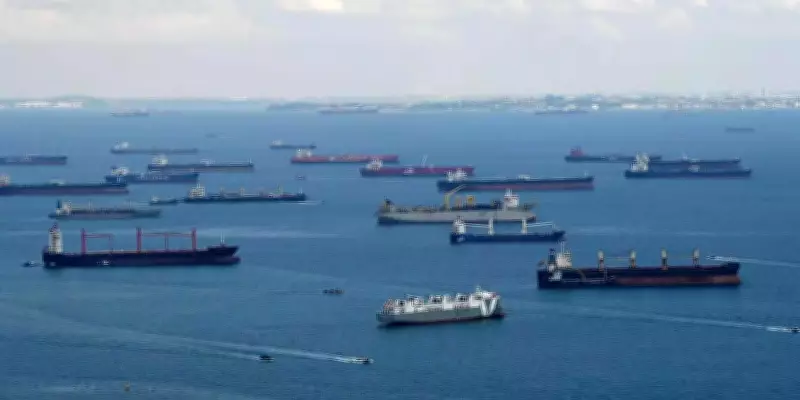
The Strait of Malacca is not only one of the world's busiest shipping lanes but also the most critical maritime artery for global energy trade. According to the latest EIA World Oil Transit Chokepoints analysis, the strait carried about 23.2 million barrels per day of oil in the first half of 2025, accounting for nearly 29% of total global seaborne oil flows, making it the largest oil chokepoint by volume, surpassing the Strait of Hormuz.
Additionally, around 9.2 billion cubic feet per day of liquefied natural gas (LNG) transited through the route during the same period. For China, the significance is even more pronounced. Observer Research Foundation (ORF) estimates indicate that China's energy imports reached about $390 billion in 2024, with nearly 80%, roughly $312 billion worth, passing through the Malacca Strait.
This corridor serves as the shortest and most efficient sea link between energy producers in the Middle East and consumers in East Asia, making it indispensable for sustaining China's industrial economy and trade flows. A narrow sea lane, which China does not control, could become a chokepoint in times of conflict, with immediate consequences for China's energy security, manufacturing output, and economic stability.
Mitigation Efforts and Limitations
In response, China has attempted to mitigate this vulnerability through diversification, investing in overland pipelines, expanding connectivity under the Belt and Road Initiative, and developing port networks across the Indian Ocean, sometimes described as the "String of Pearls." However, these alternatives remain limited in scale and efficiency, unable to fully match the speed, capacity, and cost advantages of the Malacca route, leaving China structurally exposed to potential maritime disruption.
India's Strategic Role in the Indian Ocean
For India, China's activities in the Indian Ocean, particularly near Sri Lanka and critical sea lanes, carry clear strategic implications. India's proximity to the Malacca Strait and its Andaman and Nicobar Command provide a vantage point over key shipping routes.
Over the years, India has:
- Strengthened maritime surveillance in the eastern Indian Ocean
- Expanded naval presence near the Andaman and Nicobar Islands
- Enhanced partnerships with countries like the US, Japan, and Australia through groupings such as the Quad
These measures aim partly to maintain leverage over vital sea lanes, including the Malacca Strait. China's increased mapping activity near these waters suggests it is preparing for scenarios where access could be contested.
Civil-Military Fusion and Global Ambitions
A defining feature of China's approach is the integration of civilian research and military objectives, known as "civil-military fusion." Research vessels operated by universities and state agencies participate in mapping missions, with findings potentially used for defence purposes.
Ryan Martinson of the US Naval War College told CNN that the scale of Chinese marine research is "astonishing," warning it could erode the US Navy's long-standing advantage in undersea knowledge. China's ambitions extend globally, with vessels mapping seabed areas near Alaska and Arctic sea routes, aligning with its goal of becoming a "polar great power" by the 2030s.
This global footprint reflects a broader shift: China is positioning itself as a major maritime power capable of operating far from its shores. Collin Koh, a maritime security expert in Singapore, informed Reuters: "They now have a reasonably good picture of the maritime domain they hope to operate in, either in peacetime or in war."
Implications for the Future
China's ocean-mapping campaign signifies a long-term strategic shift rather than a short-term tactical move. By merging scientific research with military planning, Beijing is constructing a detailed understanding of the underwater domain, which could shape future naval conflicts.
For India, the implications are immediate, as increased Chinese presence and data-gathering in the Indian Ocean could challenge its traditional regional advantage. For the US and its allies, the concern is broader: a potential narrowing of the undersea intelligence gap that has historically favored Western navies.
As competition intensifies beneath the surface, the oceans are emerging as a critical frontier, not only for trade and resources but for strategic dominance in an increasingly contested maritime world.