Indore: The first phase of the 2027 census commenced in Indore district on Friday with house listing and housing census operations. The district has been divided into 5,934 blocks to ensure comprehensive coverage during this month-long exercise.
For the first three days, enumerators have been tasked with visiting their assigned blocks to identify boundaries and conduct online mapping to create digital layout maps. This step has been designed to identify and include every structure in the district. Following the mapping, enumerators will begin the counting of houses.
The entire process has transitioned to an online portal, allowing for real-time data collection. As soon as an enumerator saves the gathered data, it is forwarded to supervisors for verification before being uploaded to the central portal. To support this massive undertaking, over 6,000 enumerators (including reserves) and more than 1,200 supervisors have undergone specialized training. Prior to this phase, numbering was completed on more than 10 lakh structures across the district.

Ahead of the field visits, a self-enumeration facility was provided to citizens from April 15 to April 30. During this window, 16,577 people opted for self-enumeration. Of them, 13,778 processes have already been completed. Citizens who utilized this facility must provide their reference ID to the visiting enumerator for verification. If a resident has forgotten their ID, the enumerator will perform a fresh count.
According to senior administrative officials, moving away from traditional paper-based methods, the portal-based collection offers several strategic advantages including collection of real-time data that is faster and more accurate information gathering.
Under the micro-level planning, there will be assessment of infrastructure in both urban and rural areas to improve identification of beneficiaries for government schemes. The teams will also be identifying vulnerable housing in areas prone to floods, fires, or earthquakes.
The team will also collect data on internet connectivity, digital resources, energy sources, and water usage to form eco-friendly policies. The urban analysis will help in understanding migration patterns from rural to urban areas to develop balanced development strategies.
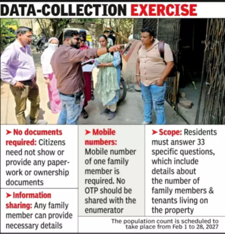
Key Points of the Data-Collection Exercise
- No documents required: Citizens need not show or provide any paperwork or ownership documents.
- Information sharing: Any family member can provide necessary details.
- Mobile numbers: Mobile number of one family member is required. No OTP should be shared with the enumerator.
- Scope: Residents must answer 33 specific questions, which include details about the number of family members and tenants living on the property.
The population count is scheduled to take place from February 1 to 28, 2027.