Karnataka Embraces GPS Technology to Revolutionize Land Survey System
In a landmark move to modernize its land administration, the Karnataka government has initiated a comprehensive plan to phase out the nearly two-century-old chain-and-staff survey method. This traditional technique, in use since 1806, will be replaced by advanced GPS-based rover devices, marking a significant technological leap for the state's revenue department.
Massive Deployment of High-Precision Equipment
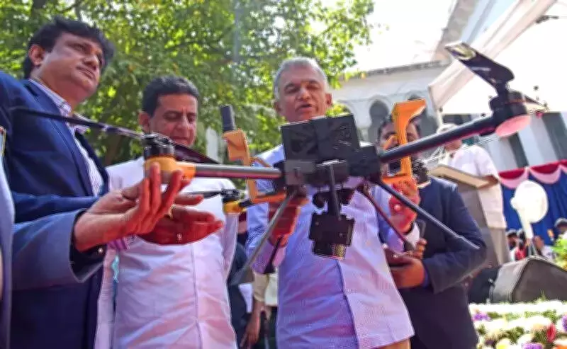
Revenue Minister Krishna Byre Gowda announced that the department has already procured 465 rover units and plans to distribute a total of 5,000 devices to surveyors across Karnataka. Agencies are currently being selected to supply the remaining units. These rover devices integrate with Continuous Operating Reference Stations (CORS) and provide coordinates with an impressive margin of error of just 1–2 centimeters.
Survey and Land Records Commissioner J Manjunath confirmed that 465 surveyors are already equipped with the new technology. The rovers will connect to 41 CORS stations statewide to ensure high-precision mapping, with primary deployment in urban areas. They will also verify digital sketches generated through recent drone surveys.

Dramatic Efficiency Gains and Accuracy Improvements
Officials report that the GPS-based system is nearly 20 times faster than conventional methods. A task that previously required two surveyors up to 20 days to complete—surveying 400 acres of land—can now be accomplished in a single day. Similarly, measuring and preparing maps for small land parcels, which took five to six hours, can now be completed within just 10 minutes.
Deputy Director of Survey and Land Records Mohan Shivannavar emphasized that the new system aims to achieve near 100% accuracy, significantly reduce manual errors, and help resolve long-pending land disputes. The traditional chain surveys were not only labor-intensive but also prone to delays and inaccuracies.
Addressing Growing Demand and Public Frustration
The reform comes amid escalating demand for land surveys and mounting delays in processing applications. The department receives over 100 daily requests for various services including property division, layout approvals, road works, and tank mapping. Applicants using the Bhoomi portal have frequently faced months-long waits due to staff shortages and challenging field conditions.
These delays have sparked protests by farmers in several North Karnataka districts, including Dharwad, Gadag, Bagalkot, Koppal, and Vijayapura. The government's modernization initiative directly responds to these concerns by streamlining processes and enhancing service delivery.
Enhanced Transparency and Digital Transformation
Under the new system, digital 'C' copies of land maps will be issued more rapidly. Updated records will feature QR codes, enabling landowners to access tamper-proof property details instantly. This innovation promises to improve transparency, reduce litigation, and empower citizens with reliable land information.
To bolster manpower capabilities, the government has issued a notification to recruit 750 new surveyors. Although recruitment faced initial delays due to internal reservation issues, Minister Gowda assured that appointment orders would be issued promptly.
Building on Previous Technological Experiments
The department had previously experimented with Digital Global Positioning System (DGPS) technology, but rover devices have proven faster and more efficient. Similar rover-based land survey systems are already operational in several Indian states including Haryana, Telangana, Andhra Pradesh, Kerala, Maharashtra, and Madhya Pradesh.
With the integration of GPS-enabled rovers, drone technology, and digital land records, Karnataka's revenue administration is poised for a major transformation. This comprehensive modernization effort aims to deliver faster, more accurate, and transparent land survey services to citizens, fundamentally improving how land administration functions in the state.