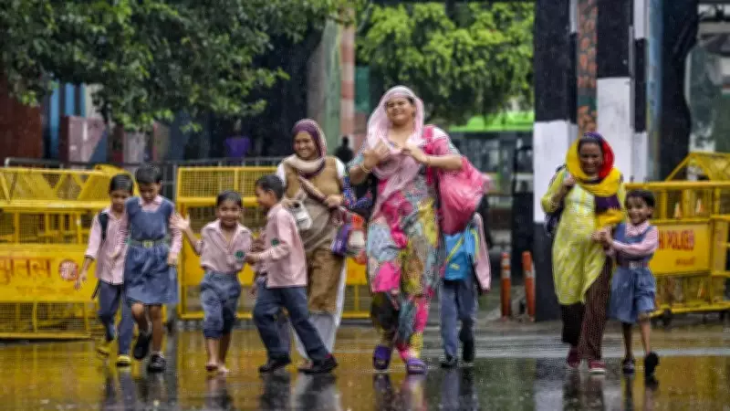
New Delhi experienced steady rainfall on Monday morning, aligning with forecasts from the India Meteorological Department (IMD) and weather experts who had predicted wet conditions across northwest India due to an active western disturbance. The rain, accompanied by overcast skies and lower temperatures, provided respite from the prevailing heat. Authorities continue to monitor the situation, with forecasts indicating further light to moderate precipitation across the region.
Weather Patterns and Expert Insights
IMD scientist Naresh Kumar stated on Saturday that weather conditions across northwest India are expected to gradually improve as the western disturbance, currently located over North Haryana, moves forward. The region has experienced substantial rainfall coupled with strong winds over the past few days. However, meteorologists anticipate a slight decrease in rainfall activity across northwest India in the coming days.
Explaining the weather pattern, Kumar noted, "Over the past few days, northwest India, including Delhi, has experienced moderate to heavy rainfall due to the influence of a western disturbance combined with moisture-laden winds from the Bay of Bengal and the Arabian Sea. This confluence has led to significant rainfall in regions like Himachal Pradesh and Uttarakhand, with wind speeds reaching up to 60-70 km/h."

Alert Status and Forecast
Regarding the alert status, Kumar said, "Currently, the western disturbance is positioned over North Haryana, and while the rainfall intensity is expected to decrease, light to moderate rainfall is still anticipated across northwest India. We have issued a yellow alert for Jammu & Kashmir, Himachal Pradesh, Uttarakhand, Punjab, and Haryana, with expected strong winds in Rajasthan."
According to the IMD, northwest India is likely to continue experiencing a wet spell until June 19 under the influence of active western disturbances. The weather department indicated that isolated to scattered rainfall is probable over Jammu & Kashmir, Ladakh, and Uttarakhand from June 13 to June 19, while similar conditions are expected in Himachal Pradesh between June 14 and June 19.
Regional Rainfall Predictions
The plains, including Haryana, Chandigarh, Delhi, Punjab, and West Uttar Pradesh, are also expected to receive isolated to scattered rainfall through June 19. East Uttar Pradesh may witness rainfall on June 13 and again between June 18 and 19, while West Rajasthan is anticipated to receive rain from June 13 to 17 and again on June 19.
The IMD further stated that isolated thunderstorms, lightning, and gusty winds are likely in Himachal Pradesh and Jammu & Kashmir during June 13-14, and in Uttarakhand through June 15. Similar weather conditions are expected in Haryana, Chandigarh, Delhi, Punjab, and West Uttar Pradesh on June 13, as well as in East Rajasthan from June 16-19 and West Rajasthan on June 15-17 and June 19.
Severe Weather Warnings
The weather department has also forecast isolated heavy rainfall in East Uttar Pradesh on June 13. Thundersqualls with wind speeds of 60-70 kmph, gusting up to 80 kmph, are likely over West Rajasthan on June 13 and East Rajasthan through June 14.
According to the latest IMD forecast, maximum temperatures in Northwest India are expected to rise gradually by 4-6 degrees Celsius until June 17, with no significant change likely thereafter. The IMD said Central India is expected to witness stable temperatures until June 17, followed by a gradual decline of 2-3 degrees Celsius through June 19.