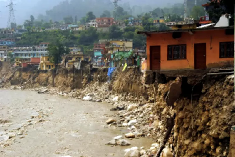
Dehradun: A new study by IIT Roorkee has used advanced artificial intelligence to map flood-prone areas across the Indian Himalayan region. The research found that nearly 85% of districts in Uttarakhand are vulnerable to extreme floods, while over 45% of Himachal Pradesh faces risks from floods, landslides and avalanches. This highlights the growing exposure of mountain communities to hydro-meteorological disasters.
Deep Learning Model for Flood Susceptibility
Researchers applied a deep learning model, CNN U-Net, to analyze flood susceptibility at a fine spatial resolution of 90 meters. The model incorporated 14 key factors, including elevation, slope, vegetation cover and water flow characteristics, to identify high-risk zones. The findings could play a crucial role in infrastructure planning, land-use regulation and strengthening disaster management systems.
Key Drivers of Flood Risk
The results showed that vegetation cover (NDVI), topographic wetness index (TWI) and elevation are the most critical drivers of flood risk in the region. Areas with low vegetation and high water accumulation potential are particularly vulnerable.

Rachit, author and PhD research scholar at IIT Roorkee, said developing the framework involved translating complex terrain and environmental data into a form that AI models can effectively learn from. "The goal was to create a system that is not only accurate but also fast and practical for real-world flood mapping in Himalayan terrains," he added.
Vaibhav Tripathi, co-author and PhD research scholar at IIT Roorkee, noted, "Bringing together different terrain and environmental factors into a single framework helps capture how floods develop in complex mountain regions."
High Accuracy and Validation
The model achieved an overall accuracy of 97.12%, indicating strong reliability in identifying flood-prone zones even in complex mountainous terrain. Researchers claimed that such high accuracy is significant given the limited availability of historical flood data in the Himalayas.
Mohit P Mohanty, corresponding author and faculty at IIT Roorkee, said, "The increasing frequency of flash floods in the Himalayan region demands faster and smarter solutions. Our work shows that AI-driven flood susceptibility mapping can provide reliable, near real-time insights, helping authorities act early and reduce risks to lives and infrastructure."
The study also validated its findings against real flood events. High-risk zones identified by the model closely matched areas that experienced flooding during recent monsoon events, including regions in Uttarakhand such as Rudraprayag and along key road corridors.
AI vs Traditional Models
Scientists pointed out that traditional flood models often struggle in mountainous regions due to limited data, complex terrain and the rapid onset of flash floods. In contrast, the AI-based approach can quickly generate detailed risk maps, making it more suitable for early warning and disaster preparedness.
Context of Extreme Weather Events
The research comes against the backdrop of increasing extreme weather events in the Himalayas. Past disasters such as the 2013 Kedarnath floods, which claimed over 6,000 lives, highlighted the devastating potential of such hazards.
Anil K Gupta, co-author and faculty at IIT Roorkee, who is also leading ICARS, a joint initiative of the ministry of science and technology with IIT Roorkee on strategic knowledge on climate change, said, "This study demonstrates the potential of AI to bridge critical gaps in flood risk assessment in mountainous regions."