A patch of the Pacific Ocean has been quietly warming again, drawing attention from meteorologists who monitor patterns often overlooked by the public. The signals may seem minor individually: a few degrees of temperature change, shifts in sea surface temperatures, and slightly altered wind behavior. However, these small changes tend to propagate. El Niño is one of those recurring systems that originates far out at sea and then weaves itself into weather patterns thousands of kilometers away, sometimes in uneven and hard-to-predict ways.
As reported by the National Oceanic and Atmospheric Administration (NOAA), El Niño and high tide flooding could create a double whammy for coastal communities in 2026. The US National Weather Service forecasts that El Niño may develop by July 2026 and persist through winter, increasing the risk of coastal flooding in several regions.
Understanding the ENSO Cycle
El Niño is part of the ENSO cycle, a natural climate pattern that shifts between warm, cool, and neutral phases in the tropical Pacific Ocean. During El Niño, weakened trade winds raise sea surface temperatures and sea levels, influencing global weather patterns. On the US coasts, this can mean higher tides, stronger storm surges, and heavier rainfall. Combined with long-term sea-level rise, experts warn that high-tide flooding could become more frequent and severe, especially when El Niño conditions peak in 2026.

Uneven Weather Impact of El Niño 2026
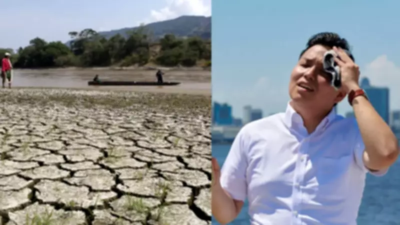
Each El Niño occurrence feels slightly different to those tracking it. Warm water gathers in the central and eastern Pacific, disrupting the usual movement of air and rain across the tropics. That shift can redraw rainfall patterns across continents. In recent observations, sea temperatures in parts of the Pacific have climbed well above average during the latest cycle, placing it among the strongest episodes recorded in recent decades.
Forecasts have broadly captured the global picture, though not every regional outcome has followed the expected path neatly. California, for instance, did not receive the steady winter rains often associated with El Niño years, while other parts of the US saw heavy and persistent precipitation. Climate models are built on patterns, but the atmosphere rarely moves in straight lines. Small changes in jet streams can send storm systems hundreds of kilometers off course. That is what happened along the US West Coast, where rainfall ended up concentrated further north than many projections suggested.
Scientists have been revisiting why some outcomes diverged so sharply from expectations. Part of the difficulty lies in how multiple systems interact at once: ocean temperatures, wind patterns, and longer-term warming trends all overlap. Even a well-established El Niño signal can be bent or diluted by these competing forces, leaving gaps between prediction and reality.
What Godzilla El Niño Really Means
The term Godzilla El Niño is not formal, but it has stuck in public discussion to describe the most intense versions of the phenomenon. These are episodes where sea surface temperatures rise several degrees above normal, and the global impact becomes more pronounced. Past strong events in the early 1980s, late 1990s, and mid-2010s were associated with severe droughts, flooding in unexpected regions, and large-scale wildfires in parts of Southeast Asia and South America.
Some researchers also draw attention to possible links between stronger El Niño cycles and broader climate variability, though the relationships are not straightforward and remain debated. There has also been discussion in academic circles about whether solar activity, such as sunspot cycles, may have some influence on ocean-atmosphere behavior. The evidence is not settled, and most climatologists treat it as an open question rather than a clear driver.

Impact on Farms, Grids, and Infrastructure
For farming regions, the impact is rarely immediate in a single dramatic moment. It tends to appear in adjustments: seeds planted later than usual, crop choices changed quietly in response to uncertain rainfall, and irrigation systems stretched further than planned. When rainfall weakens, reservoirs refill more slowly, and groundwater becomes more heavily relied upon. In cities, the consequences are felt through water supply pressures that build gradually rather than suddenly. Energy demand tends to rise at the same time, as hotter days push households and businesses towards constant cooling.
According to PIB reports, India has already recorded peak electricity demand levels above 250 gigawatts in recent years, a figure that highlights how closely power systems track temperature shifts. In a hotter-than-average season, that demand can climb further, adding strain to infrastructure that is already balancing multiple pressures.
Historical Echoes of El Niño
El Niño is not only a modern forecasting challenge. Historical accounts suggest it has been present in shaping weather-linked disruptions for centuries. Some periods marked by unusually strong events have been associated with widespread crop failures and social instability in different parts of the world. There are references in historical records to severe El Niño conditions coinciding with famine years in the late 19th century, including one exceptionally strong event in the 1870s often discussed in climate literature for its global reach. While exact casualty figures are difficult to verify with certainty, the scale of disruption described in archival material has kept that period under scrutiny. More recent decades show a clearer pattern of economic and environmental impact, from forest fires to disrupted fisheries and altered storm tracks.
What Comes Next
Forecasting centers continue to watch the Pacific closely. Some projections suggest the possibility of a stronger El Niño developing in the coming years, though timing and intensity remain uncertain. What is clearer is the background condition: a warming planet that may be influencing how these cycles behave and how their effects land across different regions.