
The closure of the Strait of Hormuz has once again highlighted the global dependence on maritime trade. This critical waterway's shutdown restricted access to 20% of global hydrocarbon trade, causing turmoil in energy markets. The closure has become a key point of contention between warring sides, leading to American blockades of Iranian ports and effectively isolating Iran from global trade.
In recent times, threats to shipping in an interconnected world have drawn sharp responses from the global community. Many nations, including India, deployed ships to protect maritime traffic through the Bab el-Mandeb during Houthi rocket attacks and Somali pirate activity.
The Dangers of Maritime Chokepoints
For centuries, access to the sea has been considered a blessing for any nation, connecting it to the wider world via oceans. Even today, with impressive rail, road, and air links, being landlocked remains a disadvantage. On land, geography dictates growth trajectories, while seas are open highways. However, the intersection of open sea and geography creates chokepoints that restrict ship movement, as demonstrated by the bottling up of the Persian Gulf due to Iranian actions at the Strait of Hormuz.

China's Big Malacca Worry
The Malacca Strait is the shortest route between the Indian and Pacific Oceans, used extensively for manufactured goods from East and Southeast Asia, predominantly China, heading to Europe and West Asia. Crude oil and gas flow in the opposite direction from West Asia to China. Nearly 75–80% of China's energy requirements pass through this waterbody.
China has long considered the Malacca Strait a major worry for its energy security. It has tried using the more southern Lombok and Sunda straits to bypass Malacca, but these deviations add 1,800 km and 3,000 km respectively to the journey, increasing cost and time for crude imports.
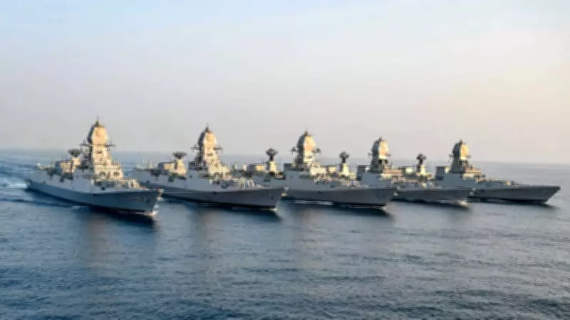
India as a Growing Maritime Power
As India grows, it invests in port infrastructure to exert economic and military influence. The government is investing Rs 6.06 lakh crore in 845 maritime projects under the Sagarmala initiative, with projects worth Rs 1.57 lakh crore already completed. One of the most important projects is the Great Nicobar Island Project, costing Rs 1 lakh crore as per the Andaman & Nicobar Union Territory administration.
Great Nicobar Island Project
The Great Nicobar Island Project is strategically important for New Delhi, both economically and militarily. The island is being developed as a major port and trans-shipment hub, improving infrastructure on India's southernmost landmass where Indira Point is located. The island lies about 40 nautical miles (74 km) from international shipping lanes passing through the Strait of Malacca, the busiest waterway in the world. Two key international waterways straddle the Nicobar archipelago: the 10-degree channel separates this island group from the Andamans to the north, and the 80-km-wide Six Degree Channel separates it from Sumatra in Indonesia to the south.
The government plans to construct an International Container Transhipment Terminal (ICTT), an international airport, and a township on the island. A transhipment terminal handles containers from bulk carrier ships, stores them, and transfers them to other vessels for onward transport. This will reduce dependency on foreign ICTTs such as Colombo, Dubai, and Singapore, saving the country millions of dollars annually in foreign exchange.
India currently has two operational transhipment terminals at Kochi and Vizhinjam, with Vizhinjam being India's only deep-water hub. Upcoming hubs at Vadhavan port and Great Nicobar Island are both deep-water ports capable of handling some of the largest container ships in the world. The ICTT is being built at Galathea Bay under the Maritime India Vision 2030, aiming to integrate the project into the global maritime economy. Plans also include a 450 MW gas and solar power plant to support these developments.

India's Unsinkable Aircraft Carrier
Through the Andaman & Nicobar Archipelago, India is strategically positioned to monitor and potentially influence traffic through the Strait of Malacca. About 82,000 ships carrying nearly 40% of global trade pass through this waterway annually. Great Nicobar Island lies roughly 150 km from the western entrance to the Malacca Strait and nearly 1,250 km from Singapore. The island group can deploy aircraft to monitor the Sunda and Lombok straits, located roughly 2,000 km and 3,000 km away respectively. The Andaman and Nicobar Islands are also India's gateway to Southeast and East Asia, as well as the west coast of the United States.
The armed forces maintain a continuous presence through four airbases, monitoring China's primary sea access routes to the Indian Ocean. The new greenfield international airport will include a naval enclave, with 100 acres allocated for defence use, according to local authorities. A Navy source stated, "The infrastructure coming up in the area will reduce the reaction time in case of any contingency in the region. Good civilian infrastructure will help build naval infrastructure as well. Once the infrastructure is in place, scaling up operations will be easier as logistics and communications improve. This will enhance the armed forces’ ability to operate across the wider region."
The Tri-Services Command
The island group hosts India's only tri-services command, the Andaman & Nicobar Command (ANC), with elements of the army, navy, and air force, formed to protect India's interests in the area. The Coast Guard also maintains a strong presence, fighting drug smuggling, human trafficking, and illegal fishing.
Concerns Over the Project
Environmentalists have raised concerns over the impact on local flora and fauna, many endemic to the archipelago. The National Green Tribunal (NGT) dismissed pleas linked to the project earlier this year, stating that the environment clearance was backed by sufficient safeguards. Environment Minister Bhupender Yadav stated last year that local Shompen and Nicobarese tribals are only being relocated from the New Chingen area, and no other tribal area has been disturbed. The total tribal area on the island stands at 751 square km, while the area earmarked for new developments from the tribal fold is 84 square km. The government is re-notifying 76 square kilometers as compensation. The island has a total land mass of 921 sq km as per the UT government.


