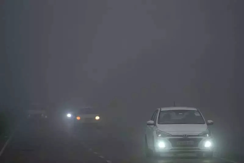
In a rare meteorological reversal, the plains of Chandigarh turned colder than the hills of Shimla on Monday, as a severe cold spell and persistent dense fog gripped the region. The city's temperatures, both day and night, dipped below those recorded in the Himachal Pradesh capital, marking a striking deviation from the usual winter hierarchy.
Temperature Plunge Creates Unusual Scenario
Chandigarh's minimum temperature settled at a chilly 7.2 degrees Celsius, which was notably lower than Shimla's 8.6°C. The daytime narrative was no different. The city's maximum temperature could only climb to 16.7°C after a sharp fall of approximately 5 degrees from the previous day. This reading was over 3 degrees below the normal expected for this time of year and remained colder than Shimla's daytime high of 18.5°C.
Data from the India Meteorological Department (IMD) confirmed that the day was significantly colder than usual. The abrupt 5-degree drop within a 24-hour window highlighted how quickly the cold wave intensified. Despite no rainfall in the past day, muted winter conditions prevailed, with the pronounced chill dominating the city's atmosphere.
Zero Visibility and Disruptive Fog
The intense cold was accompanied by a blanket of dense to very dense fog, which severely disrupted normal life. The visibility at Chandigarh airport dropped to zero around 00 UTC, creating near whiteout conditions and hampering operations. The city observatory reported visibility as low as 30 metres during the worst phase.
This fog lingered through the crucial morning hours, blocking sunlight and suppressing any meaningful daytime heating. This phenomenon was a direct contributor to the unusually cold day, as the sun's warmth failed to penetrate the thick fog layer.
IMD Forecast: Cold to Persist, Light Rain Expected
Looking ahead, the IMD forecasts that the cold conditions are likely to continue for the Tricity region. Over the next few days, maximum temperatures are expected to range between 17°C and 19°C, while minimums may hover around 5°C to 6°C.
However, a change is on the horizon around the New Year. The weather bulletin indicates the possibility of light rain around late December 31 and January 1. This rainfall is associated with an approaching western disturbance affecting the Western Himalayan region from December 30 to January 1.
The activity is likely to commence over western parts of Punjab and Haryana and extend to areas including Chandigarh. While this may bring a brief shift, the overall winter-dominated pattern is set to remain. The IMD also warns that dense fog is likely over Punjab, Haryana, and Chandigarh on December 30, with reduced visibility during late night and morning hours. Fog intensity may decrease on December 31 and January 1 before potentially redeveloping afterward.
Temperature-wise, minimums are expected to rise gradually by about 2–3°C over the next three days before falling again by a similar margin. Maximum temperatures are also likely to decrease over the next three to four days, suggesting the cold grip will not loosen anytime soon.


