Delhi's High-Rise Air Pollution Crisis: Drones Reveal Hidden Hazards
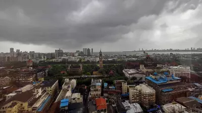
New Delhi: A groundbreaking new study has uncovered a critical gap in Delhi's air quality monitoring, revealing that pollution levels above ground level can be dramatically higher than what conventional surface stations detect. Using innovative drone-mounted low-cost sensors, researchers have documented substantially elevated concentrations of fine particulate matter at heights equivalent to high-rise buildings, raising serious health concerns for people living or working above the ground floor.
Vertical Distribution of Pollution: The Study Methodology
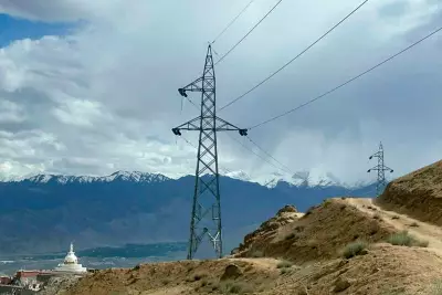
The research, conducted at IIT Delhi over five days in March 2021 during post-winter haze conditions, meticulously measured the vertical distribution of PM2.5 at 20-meter intervals from the surface up to 100 meters. The findings, published on February 2 in the Nature Portfolio journal npj Clean Air under the title "Drone measurements reveal high near surface urban haze," present alarming data about pollution stratification in the city's atmosphere.
Staggering Pollution Disparities at Altitude
At 100 meters above ground, PM2.5 concentrations reached approximately 160 micrograms per cubic meter—a staggering 60% higher than surface readings recorded on the same days. This significant disparity suggests that residents in 28–30-storey buildings may face substantially higher exposure to harmful pollutants than indicated by ground-based monitoring systems. The study specifically highlights how these elevated concentrations are attributed to stable, humid early-morning conditions that trap pollutants in shallow atmospheric layers.

Atmospheric Conditions Driving Pollution Accumulation
Researchers observed that haze formation occurred predominantly in the morning hours, before sunlight expanded the atmospheric boundary layer—the lowest portion of the atmosphere where pollutants typically mix and disperse. During these hazy periods, the boundary layer remained unusually shallow, creating conditions where high humidity, low wind speeds (below 2 meters per second), and suppressed dispersion allowed pollutants to accumulate and secondary particles to form.
The study noted that PM2.5 levels increased sharply near the top of this shallow atmospheric layer, leading to peak concentrations at around 100 meters altitude. "Vertical profiles of PM1 and PM2.5 under humid conditions (relative humidity above 70%) showed that haze formation is likely driven by hygroscopic inorganic aerosols," the researchers explained. They further detailed how secondary particle formation, moisture-driven growth, high chloride and nitrate content, and weak winds collectively intensified early-morning haze conditions.
Specific Case Studies from the Research
On March 18, particulate matter concentrations exhibited a notable 60% increase with altitude, reaching 160 micrograms per cubic meter at higher elevations compared to just 100 micrograms per cubic meter at the surface. Two days later, on March 20, a sharp inversion layer around 70 meters led to a sudden 30% jump in PM2.5 within a mere 20-meter vertical span. In striking contrast, a major rain event before March 23 dramatically reduced PM2.5 to 40 micrograms per cubic meter at the surface—representing a 60% drop compared with March 18 levels.
Implications for Urban Planning and Public Health
This research fundamentally challenges conventional approaches to air quality monitoring and urban environmental management. The findings underscore the urgent need for three-dimensional pollution assessment strategies that account for vertical distribution patterns, particularly in rapidly growing cities with increasing high-rise development. The study's revelations about pollution stratification have profound implications for public health policies, building design standards, and urban planning initiatives aimed at mitigating air quality risks for all residents, regardless of their elevation above ground level.