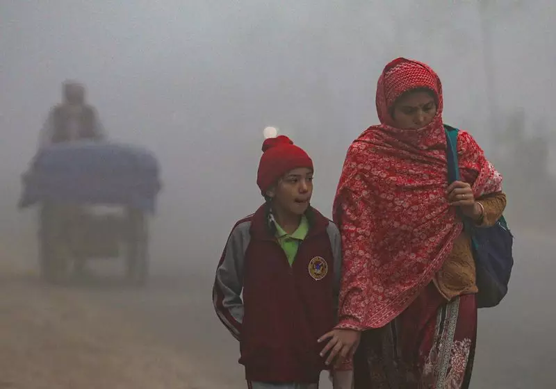
A thick blanket of fog engulfed vast parts of northern India on Thursday, significantly reducing visibility and disrupting daily life. The India Meteorological Department (IMD) has forecast that this foggy and wet weather pattern will persist, with rain and snowfall expected in Jammu & Kashmir and Himachal Pradesh over the next two to three days.
Widespread Fog and Disruptions
The foggy conditions were most severe in the plains of Punjab, Haryana, and Chandigarh, where visibility dropped dramatically. This led to considerable inconvenience for commuters, with road and rail traffic facing delays. The IMD attributed this phenomenon to light winds and high moisture levels in the lower atmosphere, a classic recipe for dense winter fog formation in the Indo-Gangetic plains.
Residents in affected areas reported a sudden dip in daytime temperatures alongside the reduced visibility. The fog layer trapped pollutants near the surface, leading to a noticeable decline in air quality in several cities. Local authorities advised people to exercise caution while driving and to use fog lights where necessary.

Snowfall Forecast for Hill States
While the plains grapple with fog, the western Himalayan region is bracing for active winter weather. The meteorological department has predicted light to moderate rainfall or snowfall at many places in Jammu & Kashmir on Friday. Similar conditions are expected in Himachal Pradesh, where isolated pockets may receive heavy snowfall.
Specifically, the IMD forecast indicates that isolated heavy rainfall or snowfall is very likely over Jammu & Kashmir on January 12th. For Himachal Pradesh, the forecast points towards light to moderate rainfall or snowfall at a few places on the same day. This wet spell is anticipated to continue influencing the region's weather for the subsequent 48 to 72 hours.
Broader Weather Patterns and Outlook
The current weather activity is driven by multiple atmospheric systems. A western disturbance is active as a trough in the middle tropospheric westerlies, which is the primary system bringing moisture and instability to the hills. Additionally, an induced cyclonic circulation lies over southwest Rajasthan and adjoining areas, contributing to the overall moisture feed.
Looking beyond the immediate forecast, the IMD has also indicated that another western disturbance is likely to affect the western Himalayan region from around January 16th. This suggests that the pattern of cold and potentially wet weather in the northern states may continue into the following week. Farmers and tourists in the hill states are advised to stay informed about the latest weather bulletins.
The combination of dense fog in the plains and anticipated snowfall in the mountains marks a definitive shift towards peak winter conditions across North India. Authorities are monitoring the situation, especially in higher altitudes where snowfall can impact travel and essential services.