IIT-Dharwad Study Uncovers Critical Landslide Vulnerability in Karnataka's Western Ghats
A groundbreaking scientific investigation conducted by the Indian Institute of Technology–Dharwad (IIT-Dh) has delivered alarming findings regarding the ecological stability of the Western Ghats in Karnataka. The comprehensive research concludes that a staggering 60.7% of the Western Ghats stretch across the state is highly susceptible to landslides. This revelation underscores escalating environmental and human risks in one of India's most ecologically fragile and biodiverse regions.
Two Decades of Data Reveals Disturbing Trends
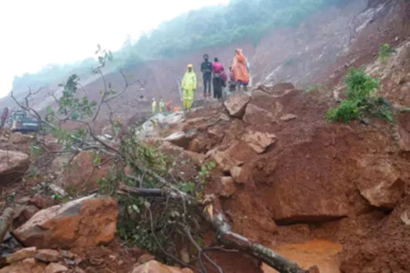
The meticulous study, which analyzed seven districts within the Karnataka segment of the Western Ghats, documents that more than 1,200 landslides have occurred in this region over the past 20 years. This disturbing frequency is attributed to a dangerous convergence of extreme natural conditions and intensifying human interference. The research was catalyzed by the tragic 2024 Shirur landslide in Ankola taluk of Uttara Kannada district, a disaster that claimed eight lives and refocused urgent attention on landslide vulnerabilities.
Employing an integrated scientific methodology, the IIT-Dharwad team synthesized hydrological, geographical, and topographical data with historical landslide records to produce an extensive landslide susceptibility map. This map provides a crucial visual tool for understanding risk distribution.

District-Wise Breakdown of Landslide Incidents
The study offers a detailed district-level analysis of landslide occurrences over the last two decades:
- Uttara Kannada: Accounts for the highest share at nearly 30%, with over 500 recorded incidents.
- Shivamogga: Follows with 17.8% of the total landslides.
- Chikkamagaluru: Records 17% of incidents.
- Kodagu: Accounts for 13.8%.
- Dakshina Kannada: Holds 9.6%.
- Hassan: Represents 8.2%.
- Udupi: Accounts for 4%.
The research comprehensively covers these seven districts: Uttara Kannada, Udupi, Dakshina Kannada, Hassan, Shivamogga, Kodagu, and Chikkamagaluru.
Primary Triggers: Nature and Human Activity
Explaining the core factors behind these disasters, Amarnath Hegde, associate professor in the department of civil and infrastructure engineering at IIT-Dh and the study's principal investigator, identified three dominant triggers:
- Intense monsoon rainfall exceeding 3,000 mm annually.
- Prevalence of clayey loam soil.
- Steep slope gradients above 28 degrees.
"These exact conditions were observed in the Shirur landslide, where rainfall crossed 3,000mm, the soil was clayey loam, and the slope gradient measured 31 degrees," Prof. Hegde stated. The team's predictive model was rigorously validated using data from this specific July 16, 2024, event. Research scholar Malay Pramanik is a key member of the core research team.
Human Interventions Exacerbating Natural Risks
The study raises a significant red flag regarding human-induced factors that are worsening landslide risks. Prof. Hegde highlighted that traditional, naturally evolved drainage networks have been frequently blocked or altered, disrupting essential natural water flow patterns. Furthermore, unscientific infrastructure development, particularly aggressive road and highway expansion projects, has critically destabilized slopes.
"In several road projects, the toe of the slope has been cut without constructing proper gabion walls. These porous structures are essential as they allow water to percolate instead of building up pressure within the slope," he explained, pointing to a common engineering oversight.
Defining Extreme-Risk Zones and Future Projections
The report definitively concludes that areas receiving over 3,000mm of annual rainfall, combined with clayey loam soil and steep slopes, fall under extreme-risk zones. Practices like unregulated slope cutting, land-use changes, and indiscriminate construction along highways have significantly amplified landslide susceptibility across the Western Ghats.

Looking to the future, the IIT-Dharwad team plans to leverage advanced machine-learning models to forecast high-risk landslide zones for the years 2050 and 2100. This next phase of research, expected to be published within the coming two months, aims to equip policymakers and urban planners with predictive tools to proactively mitigate future disasters and safeguard both the environment and communities in the vulnerable Western Ghats region.