Indore Records Sharp Temperature Spike as Skies Clear, Touching 32.2°C
Clear skies over Indore led to a significant surge in daytime temperatures, with the maximum reaching 32.2 degrees Celsius on Sunday. This reading was two degrees above the normal level for this time of year, highlighting a rapid warming trend across the city.
Rapid Temperature Increase Within 24 Hours
Just one day earlier, on Saturday, the city recorded a maximum temperature of 31.6 degrees Celsius. This represents a steep seven-degree increase within a mere 24-hour period, directly attributed to the dispersal of cloud cover that had previously provided cooling effects.
The dramatic shift becomes even more apparent when compared to Friday's conditions, when the daytime temperature dropped to 24.6 degrees Celsius. That measurement was six degrees below normal, emphasizing the volatility of recent weather patterns in the region.

Weather Conditions and Meteorological Observations
The temperature rise followed a brief period of cloud cover and rainfall that had brought temporary relief from the heat. With skies clearing completely, strong sunshine prevailed throughout Sunday, creating noticeable warmth during afternoon hours that residents could distinctly feel.
By 5:30 pm on Sunday, the temperature remained elevated at 29.8 degrees Celsius. Meteorological centre data recorded north-westerly winds at 17 kilometers per hour, with gusts reaching speeds of 32 kilometers per hour.
Nighttime Conditions and Regional Weather Patterns
Night conditions showed a contrasting pattern with a slight temperature dip. The minimum temperature settled at 13.7 degrees Celsius, which was two degrees lower than the previous night and close to normal levels for this season. At 8:30 am on Sunday, the temperature was recorded at 19.2 degrees Celsius.
No rainfall was reported in Indore during the past 24 hours, though isolated rainfall occurred elsewhere in western Madhya Pradesh in districts including Neemuch and Burhanpur.
Broader Meteorological Systems and Forecast
Meteorological officials linked the broader weather pattern to a well-marked low-pressure area over the south-west Bay of Bengal, accompanied by an associated cyclonic circulation extending up to 5.8 kilometers in height. A trough at 0.9 kilometers runs through Tamil Nadu and Karnataka into central Maharashtra.
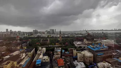
Additionally, a subtropical westerly jet stream at 12.6 kilometers altitude is positioned over north-east India, with wind speeds reaching 95 knots. Current satellite imagery indicates no significant cloud formation over Madhya Pradesh at present.
Arun Sharma from the Bhopal Meteorological Centre confirmed that weather across the state remains generally clear. He noted that isolated rainfall and thunderstorm activity are likely on Monday in specific districts including Balaghat, Mandla, Dindori, Umaria, Anuppur, and Shahdol.
Looking ahead, from February 24 to 26, conditions are expected to remain mainly clear across the region. Meteorological projections indicate no major changes in minimum or maximum temperatures over the next five days, suggesting a period of relative stability following the recent temperature fluctuations.