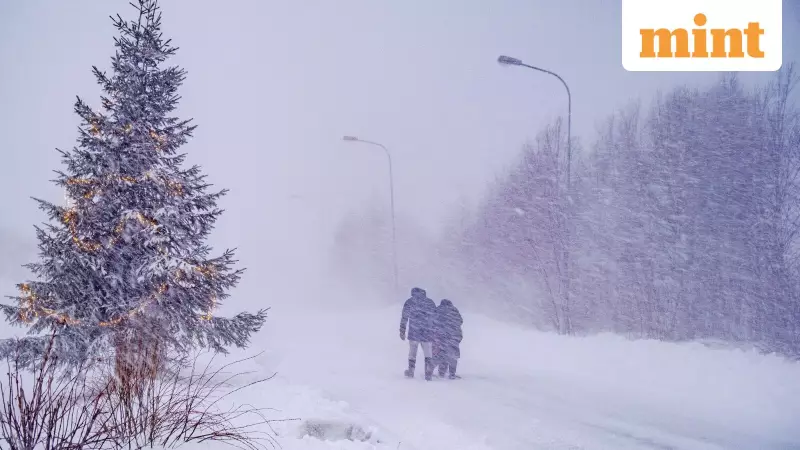
A dangerous and intense winter storm, supercharged by a rapidly developing 'bomb cyclone', is sweeping across a vast portion of the United States, creating severe and hazardous weather conditions. The National Weather Service (NWS) has issued warnings for heavy snow, blizzards, extreme cold, and damaging winds affecting millions.
What is a Bomb Cyclone and Where Will It Hit?
According to the NWS bulletin dated December 28, an intense cyclone is set to dominate the weather over the next 48 hours. Meteorologists explain that a 'bomb cyclone' or bombogenesis occurs when a low-pressure system deepens rapidly, leading to harsh weather. This particular system is developing over the Mid-Mississippi Valley where frigid Arctic air from Canada is colliding with an unusually warm air mass lingering over the Central and Southern US.
The storm's impact is expected to stretch across a massive area, from Montana east to Maine, and Texas north to Pennsylvania. The NWS predicts the storm will bring a range of severe conditions, including heavy snow and blizzards in the upper Midwest and Great Lakes, freezing rain in New England, thunderstorms in the East and South, and widespread, potentially damaging winds.

Detailed Forecast and Expected Impacts
As the low-pressure system accelerates northeastward, heavy snow and blizzard conditions will continue through Monday in the upper Midwest and Great Lakes. The NWS forecasts that snowfall could well exceed a foot, with the possibility of up to two feet of snow along the south shore of Lake Superior, accompanied by whiteout conditions.
By Monday morning, a mix of snow, sleet, and freezing rain is likely in northern New England before warmer air changes it to rain. Meanwhile, across the central Great Lakes, wind-swept rain and thunderstorms are forecast to transition into a blizzard by early Monday with blowing snow. The massive storm system will slowly move into eastern Canada later on Monday, but its huge circulation will continue to drive strong, gusty winds across the entire eastern US.
Arctic Front Brings Drastic Temperature Drop
The arrival of an Arctic cold front sweeping southward was expected to bring a dramatic end to the unseasonable warmth on Sunday. A quick round of strong thunderstorms signalled the arrival of this frigid air, known as a "Blue Norther". The NWS stated that rain showers should taper off or end as light snow across Maine by Tuesday morning in the wake of this cold front.
Residents across the affected regions are urged to prepare for dangerous travel conditions, potential power outages, and life-threatening cold. The combination of heavy precipitation, high winds, and plunging temperatures creates a significant risk to life and property, underscoring the severe nature of this bomb cyclone event.