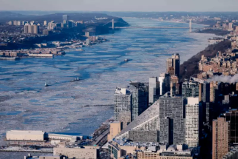
Late January delivered a sharp, intensified winter to the New York metropolitan region, transforming its iconic waterways with a blanket of ice. Following days of unrelenting cold, ice accumulated across the Hudson River along Manhattan's western shoreline, dramatically changing the appearance and flow of one of the city's most vital aquatic corridors.
Satellite View Reveals Widespread Freeze
A striking satellite image captured this transformation in vivid detail, showing ice pressing against shorelines and drifting through slower-moving channels. The scene documented not a brief storm but a sustained cold spell, with temperatures remaining below freezing for over a week. While the freeze disrupted transportation and daily routines at street level, from above it provided a serene yet powerful record of how prolonged Arctic air rapidly reshaped the city's rivers, parks, and urban landscape.
NASA's Landsat 8 Captures the Scene
The image was acquired by NASA's Landsat 8 satellite using its Operational Land Imager. Taken around midday on January 28, it employs a false-color view to distinguish between ice, open water, and snow. In this visualization, ice appears as pale blue, while vegetation shows up as red. The Hudson River stands out most prominently, though ice is also visible in the East River, the Central Park reservoir, and various waterways across parts of New Jersey. Snow covers much of the surrounding land, completing the winter tableau.

Prolonged Cold Drives Significant Ice Formation
Temperatures in New York City dipped below freezing on January 24 and stayed there for more than a week. On the day of the satellite pass, the high reached only 23 degrees Fahrenheit. Wind chills made conditions feel even colder across much of eastern North America as Arctic air pushed southward. These sustained low temperatures allowed river ice to thicken and spread, particularly in calmer upstream sections where water freezes more readily.
Ice Drifts from Upriver into the City
Scientists note that much of the ice observed near Manhattan likely formed farther north. Upriver sections of the Hudson experience weaker tidal currents and lower salinity, enabling ice to develop earlier and then drift southward. A complete freeze near Manhattan is a rare occurrence, not seen since the late nineteenth century. Nevertheless, the recent buildup was substantial enough to interrupt services, forcing NYC Ferry to suspend routes for several days.
Frozen Rivers Impact Transport and Ecosystems
River ice carries broader implications beyond immediate disruptions. It can increase flood risks, strain infrastructure, and alter water quality. Changes in ice cover also affect aquatic habitats during winter months. For these reasons, agencies are increasingly relying on satellite tools such as radar and hyperspectral imaging to monitor ice conditions. These advanced methods help track movement and thickness when ground-based observations are limited or challenging.
Winter's Signature Across the City
Beyond the rivers, winter left additional marks on the urban environment. A storm on January 25 deposited nearly 12 inches of snow in Central Park. The low winter sunlight cast long building shadows across Manhattan's streets. Even local folklore contributed to the seasonal narrative when Staten Island Chuck, the famed groundhog, predicted more winter ahead. Current forecasts suggest the cold conditions are likely to persist a little longer, extending this frigid chapter.
This extended cold snap, vividly captured from space, underscores how extreme weather can swiftly alter urban landscapes, prompting both adaptation and closer observation through technological means.