A powerful surge of frigid Arctic air has gripped the United States, sending temperatures plummeting below zero in the upper Midwest and triggering the first significant school closures of the season in Virginia. This cold snap, driven by a displacement of the polar vortex, is just the first in a series of brutal winter outbreaks forecast to batter the central and eastern US over the coming weeks.
Deep Freeze and Snow Disrupt Daily Life
Over the weekend, a fresh blast of cold Arctic air caused temperatures to dive below freezing across parts of the upper Midwest. This follows record cold that hit the nation's Heartland last week. According to weather experts, this is the first of several clipper systems moving through the Midwest and Northeast, promising repeated shots of cold air and chances of snow throughout the week.
The icy grip tightened on Monday as the colder air swept south and eastward, plunging temperatures along the Appalachians and the crucial I-95 corridor. Major cities like Philadelphia, New York, and Boston saw temperatures drop by as much as 10 degrees between Sunday and Monday. Highs on Monday and Tuesday afternoons struggled to rise above freezing, with breezy conditions making it feel even colder for residents along the coast.

Virginia Schools Shut Amid Season's First Snowfall
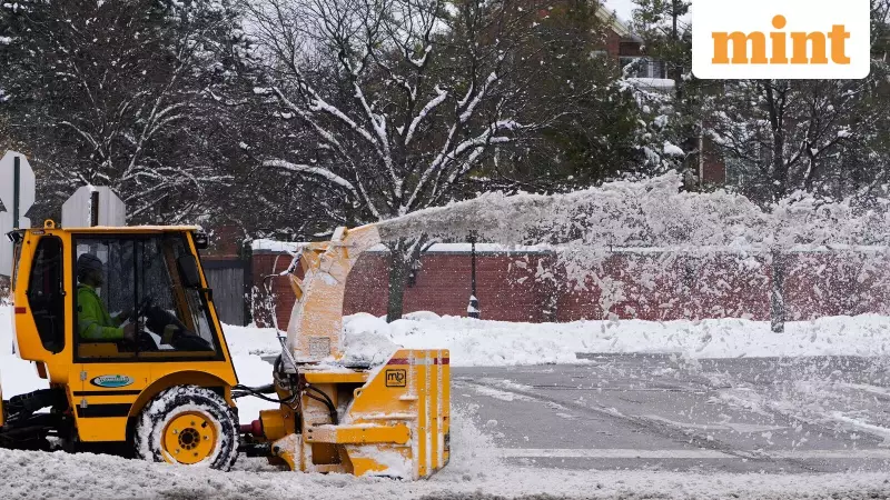
Meanwhile, winter weather is causing significant disruptions in Virginia. Most of the state is expected to receive 1-4 inches of snow on Monday, December 8, just days after a similar snowfall blanketed the region. In anticipation of hazardous conditions, numerous Central Virginia schools and districts announced closures for the day.
The snowfall was predicted to begin around 7 am on Monday, with accumulations varying between 2 and 4 inches. The list of closures included:
- Amelia County Public Schools
- Buckingham County Public Schools
- Colonial Heights Public Schools
- Hanover County Public Schools
- Henrico County Public Schools
- Powhatan County Public Schools
- Prince George County Public Schools
- Longwood University
This widespread shutdown highlights the severe impact of this early winter weather on daily routines and public safety.
More Frigid Blasts and Record Lows on the Horizon
Meteorologists warn that the current chill is merely a precursor to a more prolonged period of extreme cold. A breakdown in the Polar Vortex is forecast to unleash several more bitter cold waves across the US in the coming days. AccuWeather senior meteorologist Renee Duff confirmed that a displacement of the polar vortex is allowing Arctic air to seep deeply into the central and eastern US.
"A second cold outbreak is in the forecast next week, and a third round of frigid air is likely during the middle of the month," Duff added. AccuWeather Lead Long-Range Meteorologist Paul Pastelok echoed this, stating on their website, "The outbreak this week will be the first of probably three such rounds."
The National Weather Service has indicated that more record-low temperatures could be shattered. "Some subzero overnight lows are likely across portions of the Dakotas and into Minnesota," they reported. These successive waves of Arctic air will not only generate flurries and squalls but are also expected to lead to significant surges in energy demands as Americans crank up their heating.
While the East freezes, other parts of the country face different threats. The National Weather Service predicted isolated damaging winds and a possible brief tornado for parts of Florida. Simultaneously, the Pacific Northwest is bracing for heavy rain from a strong atmospheric river system expected to linger through the week.