Bihar Makes Geospatial Analysis Compulsory for Major Infrastructure Projects
The Bihar state government issued a significant directive on Wednesday. Officials now must use geo-spatial analytics for approving all infrastructure projects valued at Rs 50 crore or more. This new rule applies to every government department across the state.
Chief Secretary Announces New Mandate
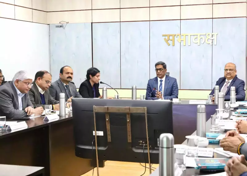
Chief Secretary Pratyaya Amrit chaired a review meeting of the Bihar Remote Sensing Application Centre (Birsac). He stated clearly that integrating Birsac's geospatial capabilities into infrastructure planning is essential. This approach will make development projects more scientific, data-driven, and ready for the future.
Amrit instructed all departments to incorporate these geospatial inputs right from the initial planning stage. Doing this will help avoid technical problems, administrative hurdles, and land-related obstacles later in the project lifecycle.

Affordable Access and New Digital Tools
The chief secretary provided important financial details. Departments using these geospatial services will pay only 0.25 percent of the total project cost. This small fee ensures the system's sustainability without placing a heavy financial burden on the state government.
Secretary Pratima from the Department of Science, Technology and Technical Education shared news about a new digital tool. Officials are developing this tool in collaboration with the Bhaskaracharya Institute of Space Applications and Geo-Informatics (BISAG-N).
This tool will specifically help with Detailed Project Report (DPR) preparation. It will use existing departmental data available on the PM Gati Shakti Portal. The goal is to assist with project planning, alignment, and assessment, leading to more accurate and reliable DPRs.
Expected Benefits and Wider Applications
Senior officials at the meeting agreed on several key advantages of this new system.
- It will prevent duplication of work between different departments.
- The system should reduce overall project costs.
- It enables early identification of potential obstacles like land disputes, forest areas, and cross-drainage issues.
The applications extend beyond basic planning. The geospatial system will also support disaster management efforts. It can be used to monitor activities such as stubble burning. Government departments can leverage these services whenever they have a specific need.
Strengthening Coordination and Capacity
Chief Secretary Amrit issued further instructions to ensure the system's success. He directed all departments to provide regular updates on project progress through the designated portal. He also emphasized the need to strengthen coordination between different departments working on interconnected projects.
Amrit appreciated the work already done by Birsac. He urged the centre to continue enhancing its technical capabilities and human resources to meet the growing demand for geospatial analysis.
The high-level meeting saw attendance from key officials including Development Commissioner Mihir Kumar Singh, Secretary Pratima, and numerous additional chief secretaries, principal secretaries, and secretaries from various state departments.
What is Geospatial Analytics?
Geospatial analytics is a powerful form of computational analysis. It leverages geographic information, spatial data, location data, and high-resolution imagery. Often incorporating artificial intelligence (AI), it is widely used in urban planning, logistics, and environmental science to make informed, location-based decisions.