Many Americans view buying a house as a path to safety, security, and stability. Years of savings go into building a sufficient down payment to get that perfect house in a safe neighborhood with good schools and peaceful streets, complete with a backyard for weekend celebrations. At the signing of the mortgage papers, they feel safe and confident in their assumption that proper zoning laws have ensured that their home will not be situated on hazardous ground. They look into maps that assure them they are not within high-risk areas. But a gap in the nation's flood mapping system could leave many homeowners exposed.
The Gap in Traditional Flood Mapping
The gap exists because traditional auditing is slow and struggles to keep up with urban growth and climate change. Historically, traditional environmental audits relied on paper records, field surveys, and costly engineering studies, leaving much of the country undocumented or out of date. If developers build a new subdivision or heavy rain changes local water patterns, existing paper records can quickly become outdated and no longer reflect conditions on the ground. That gap can leave homeowners unaware that their property may be at risk.
Innovative Computational Audit Reveals Hidden Risks
To address the problem, an international team of engineering and computer science researchers reexamined how countrywide flood risk is mapped. In a study published in Nature Communications under the title "Deep learning completes US flood hazard maps revealing millions exposed to previously unrecognised risk," lead authors Wu, Zhang, and Stouffs used artificial intelligence to improve U.S. flood hazard maps. Instead of waiting for slow, piecemeal local updates, the team fed vast quantities of topographical data, satellite imagery, and regional elevation details into a sophisticated neural network designed to simulate water flow patterns across every square mile of the country.

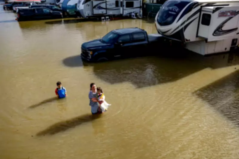
Indeed, during the simulation, a great discrepancy between recorded information and actual geographic exposure risks was discovered. According to the study, about 11 million people and 4.1 million buildings are currently situated in places where flooding can take place, but which remain unknown to anyone. These buildings may not appear in existing flood maps, which could affect insurance and planning decisions. Therefore, one should recognize that insufficient knowledge can be harmful.
Implications for the Property Market
The findings could have implications for the regional real estate market. When insurers, lenders, and developers rely on underestimated hazard maps, development may continue in vulnerable areas. For example, homeowners in those areas might face higher insurance rates and potential property losses as flood maps are updated.
Addressing the risk will require coordination among city councils, community leaders, and residents. With more precise data, authorities can update zoning rules and strengthen vulnerable infrastructure before future floods. For homeowners, the study is a reminder to check local flood risk and land-use planning.