AI-Powered Landslide Study Reveals Critical Risks in Visakhapatnam's Hill Ranges
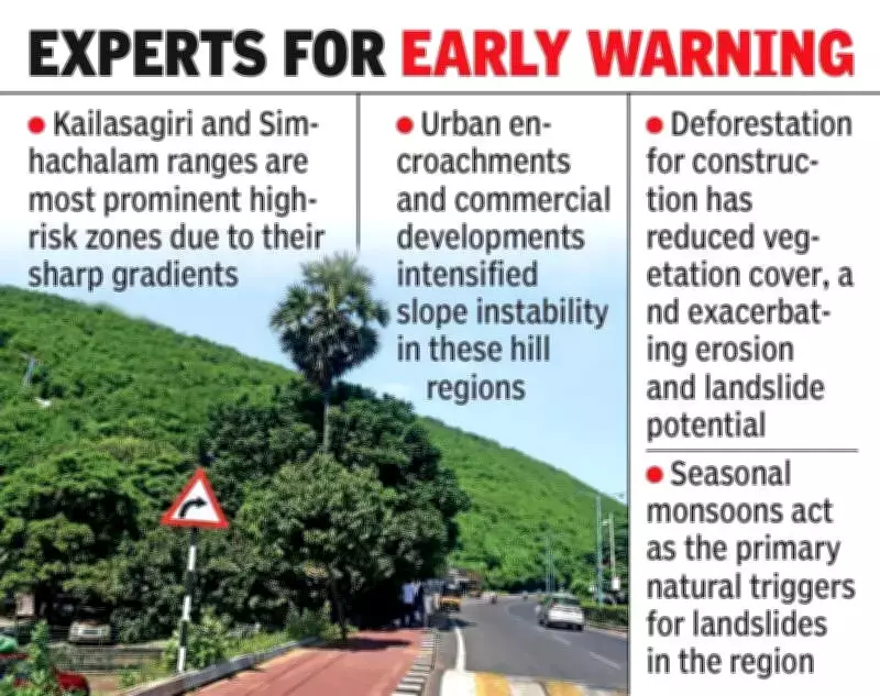
A groundbreaking scientific investigation has determined that approximately 15% of the hilly terrain in Visakhapatnam is classified as highly vulnerable to landslides. The research specifically identifies the Kailasagiri and Simhachalam hill ranges as areas of concentrated risk, highlighting significant geological concerns for the coastal city.
Comprehensive Hazard Assessment Through Advanced Technology
The study's researchers developed a detailed landslide susceptibility map using sophisticated geographic information systems (GIS) and artificial intelligence methodologies. This innovative approach categorizes the city into five distinct risk classifications: very low, low, moderate, high, and very high. This represents one of the most thorough and technologically advanced hazard assessments conducted in the region to date.
Methodology: Combining Field Data with Machine Learning
Scientists employed the Random Forest algorithm, a powerful machine learning technique, to analyze multiple environmental factors. The research team, led by Dr Ch Kannam Naidu, Dr Ch Vasudeva Rao, Y Priyanka, and T Rohini from the Visakha Institute of Engineering and Technology, integrated comprehensive field surveys with satellite imagery and historical landslide data.

The analysis examined twelve critical environmental variables including:
- Slope angle and gradient
- Land use patterns and urban development
- Geological rock types and composition
- Rainfall patterns and precipitation data
- Proximity to roads and transportation infrastructure
Key Findings: Geological and Urban Factors Driving Risk
The investigation revealed that steep slopes featuring weathered Khondalite rock formations near construction sites and road networks are particularly susceptible to slope failures. In contrast, flatter coastal areas and plains generally fall into lower risk categories, demonstrating the geographical specificity of the hazard.
Rapid urban expansion has significantly intensified landslide vulnerabilities throughout the region. Unscientific construction practices, widespread deforestation, and disrupted natural drainage patterns have collectively weakened hill stability. The study warns that even extended periods of rainfall could potentially trigger slope failures in identified high-risk zones.
Proposed Solutions and Future Applications
The research team has proposed transforming their assessment system into a dynamic early-warning mechanism. This enhanced system would integrate real-time rainfall monitoring data with Internet of Things (IoT)-based ground sensors to provide timely alerts and predictive capabilities.
Experts recommend several critical measures to mitigate landslide risks:
- Implementation of stricter building regulations and zoning restrictions in high-risk hill areas
- Mandatory geotechnical investigations and soil testing before approving new construction projects
- Engineering interventions including retaining walls, slope anchoring systems, and improved stormwater management infrastructure
This comprehensive study provides vital data for urban planners, policymakers, and residents, offering evidence-based guidance for sustainable development in Visakhapatnam's challenging terrain while addressing growing safety concerns in the rapidly expanding metropolitan area.