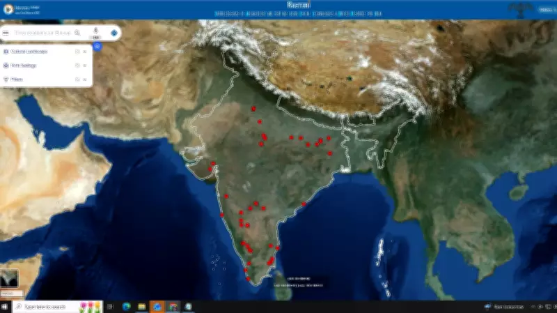
The National Institute of Advanced Studies (NIAS) in Bengaluru has developed a pioneering digital portal designed to trace and map hidden heritage landscapes across India. This innovative platform leverages satellite imagery, archival references, and geospatial markers to uncover and document historical sites that have been obscured over time.
How the Portal Works
The portal integrates high-resolution satellite data with historical maps, texts, and photographs to identify potential heritage sites. Geospatial markers allow researchers to pinpoint exact locations and overlay historical data onto modern landscapes. This approach helps reveal archaeological features such as ancient settlements, trade routes, water management systems, and sacred groves that are not visible from the ground.
Key Features of the Platform
- Satellite Imagery Analysis: Multi-temporal satellite images are used to detect changes in vegetation, soil marks, and topography that indicate buried structures.
- Archival Integration: Historical documents, colonial records, and old photographs are cross-referenced to validate findings.
- Geospatial Mapping: Interactive maps allow users to explore heritage landscapes with detailed markers and descriptions.
- Community Contribution: The portal may include features for local historians and citizens to submit information about lesser-known sites.
Importance for Heritage Conservation
This tool is crucial for documenting and preserving India's rich cultural heritage, especially sites threatened by urbanization, agriculture, or neglect. By creating a comprehensive digital record, researchers and policymakers can prioritize conservation efforts and raise public awareness. The portal also serves as an educational resource, enabling students and scholars to study hidden landscapes remotely.

Future Prospects
NIAS plans to expand the portal's coverage to include more regions and collaborate with state archaeology departments. Machine learning algorithms may be incorporated to automate the detection of potential heritage sites from satellite data. The initiative aligns with global efforts to use technology for cultural heritage preservation.
Developed by a team at NIAS, the portal is expected to be accessible to the public soon, offering a unique window into India's hidden historical landscapes.