The India Meteorological Department (IMD) has attributed the recent spate of thunderstorms in Karnataka to elevated moisture levels in the atmosphere. Meteorologists note that while such weather patterns are typical during the pre-monsoon season, the intensity of rainfall this year has been notably higher, particularly in coastal and north interior parts of the state.
Current Weather Scenario
According to IMD officials, the high moisture content is a result of increased evaporation from the Arabian Sea and the Bay of Bengal, combined with local factors. This has led to the formation of strong convective clouds, triggering thunderstorms accompanied by heavy downpours, gusty winds, and lightning strikes. Regions such as Dakshina Kannada, Udupi, Uttara Kannada, and parts of north interior Karnataka like Belagavi, Dharwad, and Hubballi have witnessed significant precipitation over the past few days.
Pre-Monsoon Patterns
Meteorologists explain that pre-monsoon thunderstorms, often called 'mango showers,' are common in Karnataka from March to May. However, this year's rainfall has exceeded normal levels in several districts. The IMD has recorded a 30% surplus in rainfall for the state during the pre-monsoon period, with coastal areas receiving up to 50% more than the seasonal average. This anomaly is linked to a persistent trough of low pressure over the region and an active easterly wave.

Impact and Warnings
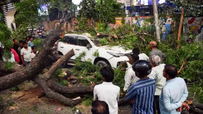
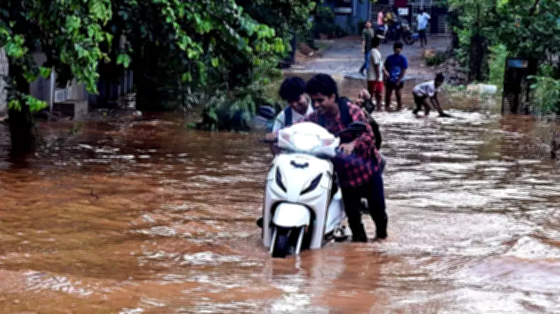
The intense weather has disrupted daily life in affected areas. Waterlogging on roads, uprooted trees, and damage to property have been reported from multiple districts. Farmers are concerned about potential damage to standing crops, particularly in horticulture belts. The IMD has issued a yellow alert for several districts, warning of continued thunderstorm activity over the next 48 hours. Fishermen have been advised not to venture into the sea along the Karnataka coast due to rough conditions.
Climate Context
Experts suggest that the increased moisture and thunderstorm activity could be linked to broader climatic changes. Rising sea surface temperatures in the Indian Ocean are contributing to higher evaporation rates, which in turn fuel more intense weather events. The IMD is closely monitoring the situation and has urged residents to stay indoors during thunderstorms and avoid open areas.
As the pre-monsoon season progresses, Karnataka is likely to experience more such events, with the southwest monsoon expected to arrive in early June. The IMD will continue to provide updates and warnings to help mitigate risks.