
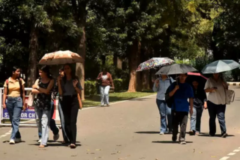
Chandigarh's First Heatwave of 2025 Officially Declared as Mercury Crosses 40°C
The Tricity region, centered around Chandigarh, experienced its first significant heat surge of the season on Friday, with daytime temperatures officially breaching the 40 degrees Celsius threshold. This milestone marks the inaugural heatwave day of 2025, according to meteorological standards.
Defining a Heatwave and Chandigarh's Current Conditions
In meteorological terms, a heatwave is declared when the maximum temperature reaches 40 degrees Celsius or higher and remains between 4.5 to 6.4 degrees above the normal seasonal average. The Chandigarh Meteorological Centre confirmed that the city recorded a peak temperature of exactly 40 degrees Celsius, which represents a substantial 5 degrees Celsius above the expected norm. Meanwhile, the minimum temperature settled at 19.4 degrees Celsius, registering two degrees below the seasonal average.
Historical Context and Temperature Trends
Meteorological records reveal a consistent pattern over the past five consecutive years, with April consistently witnessing temperatures crossing the 40 degrees Celsius mark. Last year, the highest maximum temperature in April was recorded at 41.5 degrees Celsius on April 28. In 2024, the mercury climbed even higher to 42.2 degrees Celsius on April 27. The all-time highest maximum temperature for April in Chandigarh remains 42.2 degrees Celsius, a record set in 2022.

What distinguishes this year's weather pattern is the remarkable temperature fluctuation observed earlier in the month. On April 8, Chandigarh experienced its second coldest April day since 1969, with the maximum temperature plummeting to just 24.2 degrees Celsius. From that unusually low point, the city has witnessed a steep and rapid ascent in temperatures, signaling that intense summer conditions have now firmly established themselves across the region.
Official Forecast and Meteorological Analysis
Weather officials have indicated that the rising temperatures mark a definitive transition to sustained heat following a relatively moderate beginning to April. Surender Paul, Director of the Chandigarh Meteorological Centre, explained the current atmospheric conditions: "Dry winds are prevailing across the region, which has introduced humidity into the air and is contributing to a gradual but steady rise in temperatures. These meteorological conditions are expected to persist and may potentially trigger heatwave conditions in other parts of the Tricity over the next two to three days."
The weather department has issued a forecast predicting continued heat over the coming days. Maximum temperatures are expected to range between 38 degrees Celsius and 41 degrees Celsius over the next five-day period. Minimum temperatures are likely to hover between 20 degrees Celsius and 22 degrees Celsius. Skies will remain mainly clear to partly cloudy, with no significant rainfall activity anticipated.
Precautionary Measures and Temperature Data
Local authorities have advised residents to take necessary precautions against heat exposure, particularly during peak afternoon hours when solar radiation is most intense. Protective measures include staying hydrated, avoiding direct sunlight during midday, and wearing appropriate clothing.
Detailed temperature data for April reveals the progression toward the heatwave:

- April 1: Maximum 32.8°C | Minimum 15.8°C
- April 2: Maximum 35.7°C | Minimum 17.6°C
- April 3: Maximum 31.7°C | Minimum 19.9°C
- April 4: Maximum 30.8°C | Minimum 17.43°C
- April 5: Maximum 30.9°C | Minimum 16.2°C
- April 6: Maximum 31.9°C | Minimum 14.9°C
- April 7: Maximum 27.6°C | Minimum 18.8°C
- April 8: Maximum 24.2°C | Minimum 13.4°C
- April 9: Maximum 28°C | Minimum 12.3°C
- April 10: Maximum 29.7°C | Minimum 12.4°C
- April 11: Maximum 32°C | Minimum 15.8°C
- April 12: Maximum 31.9°C | Minimum 14.8°C
- April 13: Maximum 33.9°C | Minimum 15.2°C
- April 14: Maximum 35.5°C | Minimum 15.4°C
- April 15: Maximum 36.8°C | Minimum 16.5°C
- April 16: Maximum 38.1°C | Minimum 16°C
- April 17: Maximum 36.7°C | Minimum 20.2°C
- April 18: Maximum 40°C | Minimum 19.4°C
This temperature progression clearly illustrates the sharp climb from the early April lows to the current heatwave conditions, underscoring the volatile weather patterns characteristic of the region's transitional season.


