Active Weather System to Impact Southern and Eastern India Through Weekend
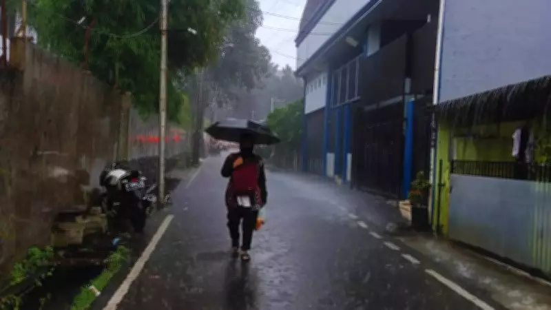
The India Meteorological Department (IMD) has issued a significant weather alert for large portions of southern and eastern India, forecasting an active weather spell from February 22 to February 25. According to the latest All India Weather Forecast Bulletin, coastal regions, peninsular interiors, and island territories will experience the most intense conditions, with heavy rainfall, thunderstorms, lightning, and gusty winds expected across multiple states.
This weather system is predicted to gradually weaken starting February 26, providing relief to affected areas after several days of potentially disruptive conditions. The IMD's detailed forecast highlights specific regions and timeframes for maximum impact, offering crucial information for residents and travelers.
Southern Peninsula Faces Peak Weather Activity
The most severe weather conditions are anticipated in Kerala and Mahe, along with Tamil Nadu, Puducherry, and Karaikal, particularly on February 22 and 23. These regions are likely to experience:

- Heavy rainfall at isolated locations
- Frequent thunderstorms accompanied by lightning
- Gusty winds reaching speeds of 30–40 kilometers per hour during storm activity
Travelers visiting Kerala's popular destinations—including beaches, backwaters, and hill districts—should prepare for short but intense rain spells that could temporarily disrupt sightseeing plans. Low-lying areas may experience waterlogging, and traffic could slow during peak showers. Similarly, tourists in Tamil Nadu's coastal towns and heritage circuits should consider indoor alternatives during storm hours.
South interior Karnataka is also expected to witness isolated thunderstorms with lightning during this period, extending the unstable weather inland. Visitors to hill stations or wildlife reserves in the region should remain vigilant for sudden cloud formation and evening showers.
Thunderstorm Activity Expands Eastward
Between February 23 and 24, thunderstorm activity is forecast to spread across eastern and parts of central India. Affected regions include:
- Gangetic West Bengal
- Odisha
- Andhra Pradesh and coastal Andhra Pradesh
- Yanam, Rayalaseema, Telangana
- Vidarbha and Chhattisgarh
These areas may experience isolated thunderstorms accompanied by lightning and gusty winds of 30–40 kmph. While rainfall may not be widespread everywhere, localized heavy showers could occur. Travelers should expect brief but heavy downpours, with lightning likely in rural and semi-urban regions during afternoon or evening hours.
Those planning road trips or outdoor tourism activities between February 23 and 25 are advised to monitor local forecasts closely and be prepared to adjust itineraries accordingly.
Andaman and Nicobar Islands Under Storm Influence
The Andaman and Nicobar Islands are also likely to experience thunderstorms with lightning and gusty winds until February 23-25, with wind speeds potentially reaching 30-40 kmph during active periods. This weather pattern may temporarily disrupt:
- Water-based activities popular in island destinations
- Ferry services connecting different islands
- Marine excursions and boat transfers
Travelers are strongly advised to stay updated on local advisories, particularly when planning marine activities or inter-island transportation.
Marine Conditions: Rough Seas and Squally Winds
Marine conditions are expected to remain rough, especially on February 22 and 23, with squally winds of 40-50 kmph gusting to 60 kmph forecast over parts of the southwest Bay of Bengal and adjoining Equatorial Indian Ocean. These conditions may result in:
- Choppy seas affecting small vessels
- Disruptions to recreational marine activities
- Potentially hazardous conditions for fishing operations
While no formal fishermen warning has been issued for the latter part of the forecast period, extreme caution is recommended during the peak wind phase early in the active weather spell.

Gradual Improvement Expected After February 25
From February 26 onward, atmospheric conditions are predicted to gradually stabilize as the weather system weakens. The absence of major warnings suggests a return to more favorable travel conditions across most affected states. While isolated thunderstorms may still occur in some subdivisions, widespread hazardous conditions are unlikely beyond February 25.
Travelers planning late-week itineraries can anticipate clearer skies and more stable weather, particularly in southern coastal destinations that experienced earlier rainfall. This transition period should restore normalcy to outdoor activities and transportation networks.
Temperature Trends in Other Regions
While southern and eastern India contend with rainfall and thunderstorms, northwest India is expected to see gradually rising maximum temperatures in the coming days. The IMD forecasts:
- An increase of 2–4 degrees Celsius in northwest India
- A rise of 3–5 degrees Celsius in central India over the next couple of days before stabilization
This temperature contrast highlights the diverse weather patterns affecting different parts of the country simultaneously.
Comprehensive Travel Advisory
For travelers across affected regions between February 22 and 25, the IMD recommends the following precautions:
- Avoid open areas during lightning activity to minimize risk
- Allow extra buffer time for road and airport transfers
- Check local marine advisories before booking water-based activities
- Secure bookings with flexible cancellation options where possible
While outdoor sightseeing, beach outings, trekking, and boat rides may face short interruptions during heavy rain spells, the overall impact is expected to be temporary rather than prolonged. Travelers who remain informed and flexible can navigate these weather conditions with minimal disruption to their plans.