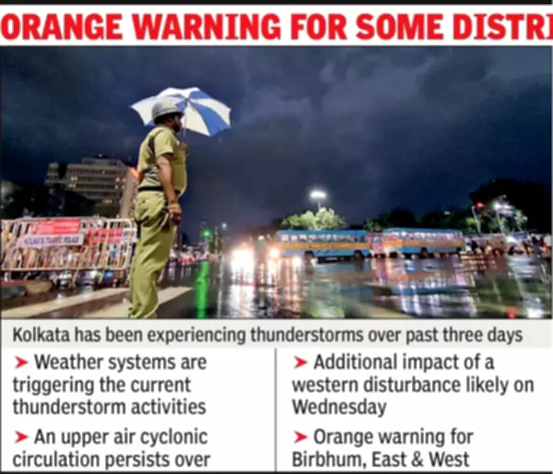
Kolkata Endures Third Consecutive Day of Severe Thunderstorms
The city of Kolkata was battered by intense thunderstorms for the third day in a row on Tuesday, with heavy rainfall, frequent lightning, and powerful gusty winds sweeping across the region. While most areas did not experience squall-level winds, the Dum Dum locality recorded a significant thundersquall, with wind speeds peaking at an impressive 81 kilometers per hour.
Flight Operations Halted Due to Dangerous Conditions
The severe weather significantly impacted operations at Kolkata's Netaji Subhas Chandra Bose International Airport. Authorities were forced to suspend all flight activities for a critical 30-minute window between 5:45 PM and 6:15 PM. This decision was made due to unsafe conditions created by squalls and strong crosswinds, which posed serious risks to aircraft during take-offs and landings.
In total, eleven flights were affected by the weather-related disruptions. Airport officials confirmed that five incoming flights had to be held in a holding pattern mid-air, while six departing flights faced delays ranging from 20 to 40 minutes. This marks the second consecutive day of major flight disruptions caused by nor'wester storms in the region.

Recurring Weather Patterns and Meteorological Analysis
On Monday, the storm activity had already led to the diversion of four flights. That evening, both Alipore and Dum Dum experienced thundersqualls, with wind speeds recorded at 63 kmph and 76 kmph respectively. The persistent bad weather is attributed to specific atmospheric conditions currently affecting the area.
According to a special bulletin issued by the Meteorological Department, an upper-air cyclonic circulation continues to persist over Odisha and its adjoining regions. Additionally, a trough extends from Gangetic West Bengal all the way to the Gulf of Mannar, passing through Telangana, Rayalaseema, and Tamil Nadu. These conditions, combined with strong moisture inflow from the Bay of Bengal, are creating an environment conducive to enhanced thunderstorm activity across various parts of West Bengal.
Extended Forecast and Expected Weather Developments
Meteorologists have indicated that the current weather pattern is likely to continue at least until Thursday, bringing one or two more spells of nor'westers across Kolkata and other districts. The situation may be further intensified by an approaching western disturbance. "We expect higher rainfall intensity along with gusty winds starting from Wednesday," stated HR Biswas from the Kolkata Met office.
The city is anticipated to receive another round of rainfall on Thursday before experiencing a brief dry phase. The recent weather has already influenced temperature patterns, with Monday night's 6-mm rainfall contributing to Tuesday's minimum temperature dropping to 20.2°C, while the maximum settled at 32°C.
Broader Implications and Preparedness Measures
The consecutive days of severe thunderstorms highlight the vulnerability of urban infrastructure to extreme weather events. Airport authorities are maintaining heightened alert levels and implementing contingency plans to minimize disruption to travel schedules. Residents are advised to stay updated with weather advisories and take necessary precautions during storm episodes.
Local emergency services remain on standby, and meteorological teams continue to monitor atmospheric developments closely. The combination of multiple weather systems creates complex forecasting challenges, but current models suggest the active phase will gradually subside by the end of the week.