Red Alert Continues as Cold Wave Tightens Grip on Punjab and Haryana
The Meteorological Department has reissued a red alert for Punjab, Haryana, and Chandigarh. This marks the second consecutive day of severe cold wave conditions. Day temperatures have plunged dramatically across the region.
Temperature Plunge Creates Severe Cold Day Conditions
Maximum temperatures are running 7 to 9 degrees Celsius below normal. This indicates severe cold day conditions at isolated places. The intense cold spell is unusual for this time of the season.
In Punjab, the average maximum temperature fell further by 2.7°C compared to Monday. It now sits a staggering 8.3°C below the normal mark. Mansa recorded the state's highest maximum at a mere 16.2°C.

Haryana witnessed a similar sharp dip. The average maximum temperature declined by 2.4°C from the previous day. It remains markedly below normal by 7.2°C. Palwal registered the state's highest at 21.5°C.
Chandigarh's reading underlined the severity of the spell. The union territory recorded a maximum temperature of only 8.9°C. This is a full 9°C below what is considered normal for this period.
Widespread Dense Fog Severely Impacts Visibility
The weather remained dry as predicted. However, dense to very dense fog blanketed most of Punjab and many parts of Haryana. This fog has severely reduced visibility, disrupting daily life.
Very dense fog was reported from several key locations:
- Amritsar, Bathinda, and Faridkot in Punjab
- Ballowal Saunkhri, Ambala, Hisar, Karnal, and Bhiwani in Haryana
Dense fog was observed in Patiala, Gurdaspur, and Chandigarh. Cold wave to severe cold wave conditions prevailed at several locations. Cold day to severe cold day conditions were reported at isolated places.
IMD Officials Warn of High Risk to Public and Services
IMD officials stated the red alert continues due to persistently low day temperatures. The severe cold wave conditions and widespread dense fog pose a significant threat.
The alert indicates a high risk to public health, transport networks, and essential services. This risk is particularly acute during the night and early morning hours.
Cold and foggy conditions are likely to persist across the Tricity region. Dense fog is expected during night and morning hours for the coming days.
Gradual Rise in Temperature Expected from January 16
The IMD forecasts a slow and gradual rise in temperatures from January 16 onward. However, temperatures are likely to remain below normal for the next few days.
Authorities have issued advisories for residents and farmers:
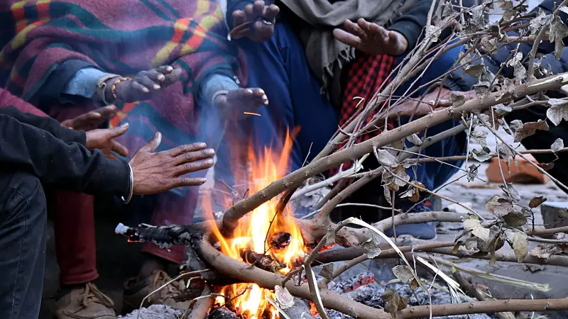
- Residents are advised to limit their exposure to the cold to prevent health issues.
- Farmers have been asked to take necessary measures to protect their crops from potential frost injury.
The situation remains critical as the region battles this intense and prolonged cold spell.