4.3 Magnitude Earthquake Strikes Gerash in Iran's Fars Province
A 4.3-magnitude earthquake struck the southern city of Gerash in Iran's Fars province on Tuesday, according to recent reports. The tremor, which occurred at a depth of 10 kilometres, was recorded by the United States Geological Survey (USGS), providing critical data on the seismic event.
Details of the Seismic Activity
The earthquake's epicenter was located in Gerash, a city known for its historical significance in southern Iran. Key aspects of the event include:
- Magnitude: 4.3 on the Richter scale, indicating a moderate tremor.
- Depth: 10 kilometres, which is relatively shallow and can sometimes lead to more noticeable shaking at the surface.
- Location: Gerash, within Fars province, an area that has experienced seismic activity in the past.
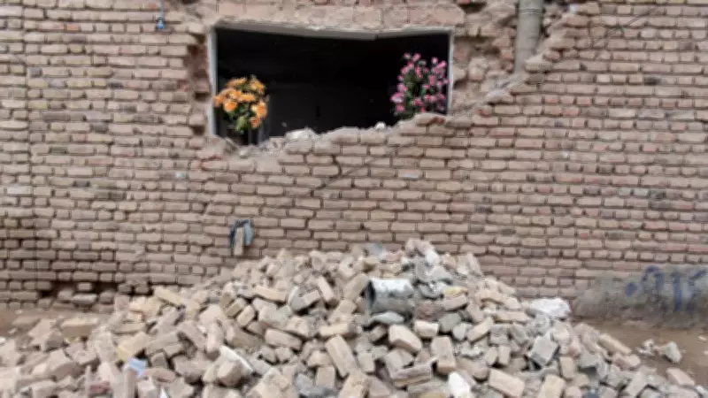
As of the latest updates, there are no reports of casualties or damage resulting from the earthquake, according to news agency ANI. This lack of immediate impact is a positive sign, but authorities continue to monitor the situation closely.

Response and Monitoring
Local and national agencies in Iran are assessing the aftermath of the earthquake. The USGS data plays a crucial role in understanding the event's characteristics, such as:
- Depth and Magnitude: These factors help determine the potential for aftershocks and structural risks.
- Geographical Context: Fars province is part of a seismically active region, making such events not uncommon.
- Public Safety Measures: Officials are urging residents to stay alert and report any unusual activity or damage.
This is a developing story, and more details are awaited as further assessments are conducted. The global community, including organizations like the USGS, remains vigilant in tracking seismic events worldwide to enhance preparedness and response efforts.