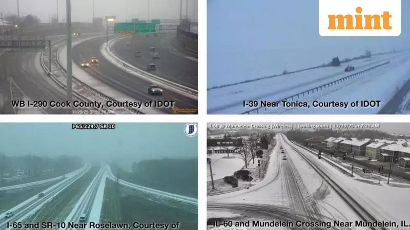
A major winter storm has descended upon Chicago, triggering a winter storm warning that remains active until 6 AM on Sunday. The severe weather conditions are significantly disrupting both road and air travel across the region, creating potentially dangerous situations for commuters and holiday travelers.
Storm Timeline and Expected Impact
According to the National Weather Service (NWS) Chicago, the most intense period of accumulating snow will occur between 12 PM and 8 PM CST. During this critical window, snowfall rates could reach up to one inch per hour, leading to prolonged accumulation that will severely impact travel conditions throughout the area.
The weather agency has issued clear warnings about what residents and travelers should anticipate: snow-covered roads, significantly reduced visibility, and genuinely hazardous travel conditions. The NWS specifically highlighted that the highest snowfall rates will persist through Saturday afternoon into the early evening, making this the most challenging period for movement.
Travel Disruptions and Flight Cancellations
The storm's impact on air travel has been substantial. According to Bloomberg reports and data from FlightAware, 656 flights across the United States have been cancelled as of 6 AM New York time. The situation is particularly dire in Chicago, where 518 of these cancelled flights were either originating from or destined for the city.
O'Hare International Airport has emerged as the hardest-hit aviation facility, bearing the brunt of the cancellations and delays. Travelers are advised to check with their airlines before heading to airports and prepare for possible extended wait times or rescheduled flights.
Extended Forecast and Safety Recommendations
The weather disturbance isn't limited to just the weekend. The NWS has indicated that several opportunities for light accumulating snow will continue into next week. The first such event is expected late Monday afternoon through Monday night, potentially bringing several inches of additional snow that could affect both Monday afternoon and Tuesday morning commutes.
Areas northwest of the Ottawa-Aurora-Waukegan line might experience even higher snow accumulations than initially forecasted. The winter storm system, which initially developed over the central and northern Plains, is progressively moving eastward into the Midwest and Great Lakes region.
Authorities have issued crucial safety guidelines for those who must travel during this period:
- Drive significantly slower than usual speeds
- Maintain safe distance from snow plows and emergency vehicles
- Consider altering or postponing travel plans entirely if possible
- Keep emergency supplies including extra flashlights, food, and water in vehicles
Iowa Governor Kim Reynolds echoed these concerns in a social media post, urging residents to remain vigilant. "As we continue to celebrate with our families and friends this holiday weekend, please closely monitor the weather conditions and follow all travel and safety guidelines. Stay vigilant and be weather aware!" the Governor stated.
Meanwhile, the western United States is experiencing comparatively warmer temperatures, creating a stark weather contrast across the country as Chicago and surrounding regions battle this significant winter storm.


