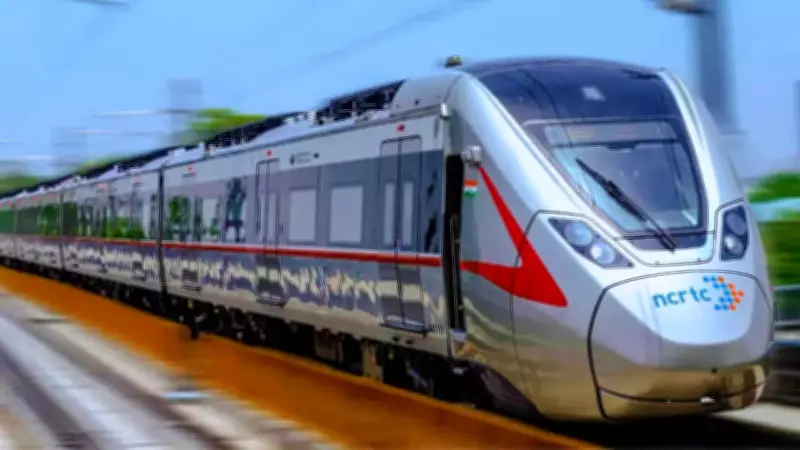
Haryana Government Greenlights Major Namo Bharat RRTS Corridor for Enhanced NCR Connectivity
The Haryana government has given its official approval to the final alignment of a significant 64-kilometer Namo Bharat Regional Rapid Transit System (RRTS) corridor. This ambitious infrastructure project is designed to seamlessly connect the key urban centers of Gurugram, Faridabad, Noida, and Greater Noida, marking a pivotal advancement in regional mobility across the National Capital Region (NCR).
Chief Minister's Announcement and Project Scope
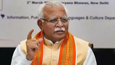
Chief Minister Nayab Singh Saini made the announcement in the state assembly on Wednesday, emphasizing the corridor's role in boosting regional connectivity. According to his official post on X, translated to English, the approved alignment will provide passengers with fast, safe, and modern transportation facilities. The corridor is set to originate at Iffco Chowk in Gurugram, move towards Faridabad, and then extend to Noida and Greater Noida. Notably, approximately 52 kilometers of the total 64-kilometer stretch will fall within Haryana's jurisdiction, giving a new momentum to the state's infrastructure development.
Detailed Alignment and Route Planning
The corridor will begin from the proposed Iffco Chowk RRTS station, part of the Delhi–Bawal corridor plan. From there, it will proceed southward through the Sector-29 road network and continue along the median of Dr BR Ambedkar Marg. Near the junction of Dr BR Ambedkar Marg and Rajesh Pilot Marg, close to Sector-61 and Golf Course Extension Road, the alignment will turn eastward toward Ghata Chowk. Beyond this point, the rapid transit line will follow the Gurugram–Faridabad Road, also known as MDR-137 or Gwal Pahari Road, ensuring direct connectivity between these two major NCR cities.

Integration with Existing Metro Systems
The RRTS corridor is planned to be integrated with multiple urban rail networks, including the Delhi Metro, the Rapid Metro in Gurugram, and the upcoming Gurugram Metro expansion. As per a Hindustan Times report from February 26, Union Minister of State and Gurugram MP Rao Inderjit Singh highlighted that the alignment in Gurugram will integrate with the proposed metro corridor between Golf Course Extension Road and Sector 5. To facilitate this, the Haryana government plans to extend the Gurugram Rapid Metro by approximately one kilometer to link it with the RRTS station at Sector 61.
The proposal outlines the creation of two integrated RRTS-cum-metro stations in Gurugram, along with six additional metro-only stations under an integrated operational model. Officials have stated that the Detailed Project Report (DPR) for the corridor is in its final stages and has been directed to be expedited.
Faridabad Stretch and Elevated Configuration
In Faridabad, the alignment proposed in the DPR has been retained with certain enhancements. The corridor will enter the city near Sainik Colony and Badhkal Enclave and proceed along Shaheed Bhagat Singh Marg, following the circular road around the NIT area. It will cross Bata Chowk at National Highway-44, integrating with the Violet Line of the Delhi Metro at the existing Bata Chowk station. From there, it will extend eastward along the sector road dividing sectors 12, 13, 14, and 15.
The alignment will then cross the Delhi–Mumbai Expressway and the Agra Canal, before turning north along Accord Hospital Road and later eastward via Mata Anandmayee Marg. Finally, it will cross the Yamuna River toward Noida in Uttar Pradesh. In Faridabad, two integrated RRTS-cum-metro stations and eight metro-only stations have been proposed as part of the integrated transit plan. The elevated configuration through the Bata Chowk area has been retained to ensure minimal disruption to existing road traffic and urban infrastructure.
Direct Airport Connectivity and Broader Impact
One of the key highlights of the project is its potential to connect two major aviation hubs: Indira Gandhi International Airport in Delhi and the upcoming Noida International Airport in Jewar, Greater Noida. The proposed network is expected to significantly reduce travel time between the two airports. An earlier DPR estimate suggested that the journey between IGI Airport’s Terminal 3 and Jewar Airport could be completed in approximately 60 to 70 minutes once the full corridor becomes operational.

The broader alignment on the Uttar Pradesh side will run from Siddharth Vihar in Ghaziabad to Noida International Airport, passing through key nodes such as Char Murti Chowk, Knowledge Park 5, Surajpur, Alpha-1, and Yamuna City sectors 18 and 21. This section will integrate with the Delhi–Meerut RRTS corridor and the Red Line Metro in Ghaziabad, connect with the Aqua Line at Char Murti Chowk and Alpha-1, and interface with the proposed Gurugram–Faridabad–Noida RRTS at Surajpur. The plan also includes provisions for linking with a future high-speed rail corridor.
The new RRTS corridor is anticipated to ease road congestion across the NCR while strengthening economic ties between Gurugram, Faridabad, Noida, and Greater Noida. The integration of multiple expressways and rapid transit systems is poised to transform commuting patterns, particularly for daily office-goers traveling between Delhi, Gurugram, and Noida, fostering a more connected and efficient regional transportation network.