The Storied Route of Auden’s Col
Auden’s Col, a high mountain pass in Uttarakhand, connects the sacred shrines of Gangotri and Kedarnath. It is one of the most challenging and historically significant treks in the Indian Himalaya, shaped by mythology and modern exploration. Named after British geologist John Bicknell Auden of the Geological Survey of India, who first spotted the pass in 1935 and crossed it in 1939, the col is the lowest crossing point linking the Rudugaira valley above Gangotri to the Bhilangana river basin. It lies on a saddle where ridges descending from Gangotri III and Jogin I peaks converge.
A Two-Week Journey Through Diverse Terrain
The trek typically takes 11 to 14 days, traversing birch and rhododendron forests, lush meadows, sweeping moraines, and vast glaciers beneath some of Garhwal’s highest peaks. Each year, only a small number of organized groups and commercial expeditions attempt the route, which remains a serious undertaking demanding endurance, patience, and adaptability to the mountains’ fickle moods.
Starting from Gangotri
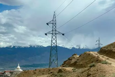
The journey begins at Gangotri town, following the Rudugaira valley upstream along the Rudra Ganga river. As trekkers move through forests and meadows, the landscape gradually gives way to rock and ice. Beyond the vegetation line, the mountains reveal their true scale. Camps are set amidst shattered boulders, glacial torrents, and vast amphitheatres of snow and ice, dominated by the imposing silhouettes of Jogin, Gangotri, and other peaks of the Greater Himalayan range.

Summit Day and the Khatling Glacier
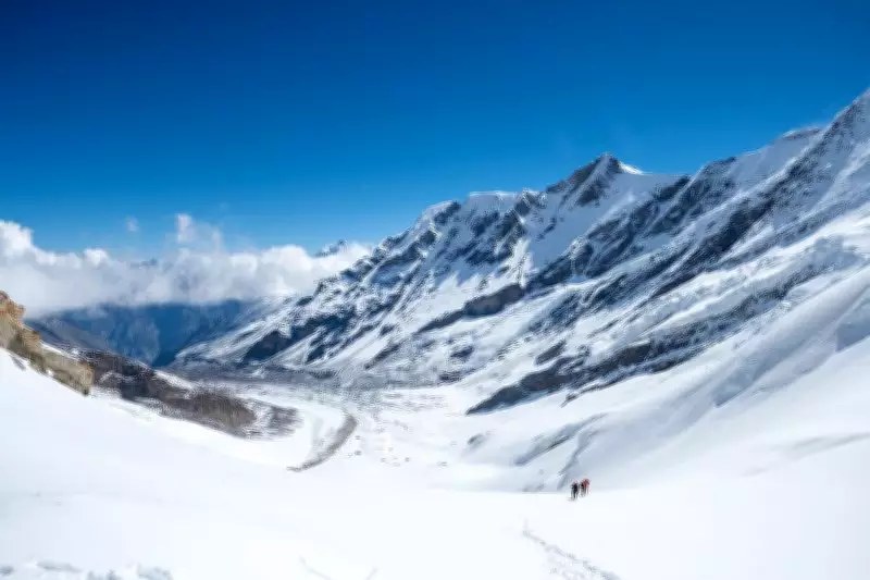
Summit day starts long before dawn, with headlamps flickering across the glacier as the group moves roped together, watching for crevasses while ascending steep slopes. At over 5,000 metres, every step requires effort. Reaching the Col brings a sense of triumph, but it is fleeting, as the other side presents the infamous Khatling glacier, a vast expanse of snow and ice whose crossing is the crux of the trek. The descent exemplifies the mountain adage that reaching the top is only half the journey. Crossing the 10-kilometer-long glacier takes two full days. What appears from a distance as a straightforward trail frequently dissolves into a maze of meltwater streams, unstable moraines, and towering icefalls, forcing repeated detours.
Constant Change in the Landscape
Even experienced guides, who have crossed the route many times, are often flummoxed, repeatedly reassessing the terrain. Sections they walked just a year ago may have disappeared, become impassable, or been transformed by rockfall and shifting ice. This serves as a reminder that these seemingly immutable landscapes are in constant flux, due to gradual natural forces or the rapidly unfolding impacts of climate change. Rare is the day without rain, sleet, or fresh snowfall. Mornings often dawn clear, only for clouds to gather by midday, swallowing peaks and reducing visibility to a few metres.
Variation via Mayali Pass
Unlike Auden, whose journey concluded after descending into Gangi village from Khatling, the modern traverse continues. After leaving the glacier, the route climbs again, this time towards Mayali Pass at approximately 5,000 metres. This variation, opened by Indian explorers in the 1980s, approaches the pass via the frozen Masar Tal and the Dudhganga glacier. Here, a newly formed lake left by a retreating tongue of ice forces trekkers to negotiate a narrow, precarious trail along its edge, where one slip means a fall into ice-cold water. These are clear signs of the Anthropocene — the imprint of human impacts on fragile natural landscapes.
Descent to Kedarnath
Crossing Mayali Pass, the route reaches Vasuki Tal, marking the transition into the upper Kedarnath valley. From there, a relatively short climb leads to the final descent towards Kedarnath. After days in near-complete wilderness, the sudden appearance of the temple town — now expanded into a bustling settlement with hotels, shops, and extensive construction — comes as a jolt. The contrast between the stark solitude of the high mountains and the frenetic pace of development is difficult to ignore.

Uncertainty Then and Now
For Auden and his contemporaries, uncertainty stemmed largely from the absence of information, making route-finding an expedition in itself. Today, trekkers carry GPS devices and detailed route descriptions. The blank spaces on maps have disappeared, but uncertainty remains, now arising from global warming and erratic weather patterns.
The Enduring Role of Mountain People
Amid all these changes, one constant has endured across more than a century of Himalayan travel: the mountain people themselves. Auden relied heavily on local men, praising their skill, endurance, and balance on difficult ice. Modern expeditions are no different. Long before dawn, guides, porters, and cooks are already awake — preparing meals, breaking and setting up camps, and ferrying heavy loads across hazardous terrain. Their quiet professionalism, intimate knowledge of the mountains, and indefatigable spirit remain the backbone of any exploration.
A Humbling and Sobering Experience
To traverse Auden’s Col today is to be humbled by the sheer scale of nature and sobered by its transient reality. It is a chance to step into a landscape that feels both eternal and urgently fragile.
Trip Essentials
Route: Begins at Gangotri town, ascends the Kedar Ganga River valley, crosses Auden’s Col (5,500 metres) into Khatling Glacier, then climbs to Mayali Pass (5,000 metres) to descend into Kedarnath.
Duration: Approximately 11-14 days.
Season: May-June (pre-monsoon) and September-October (post-monsoon).
Support: Guides and porters are mandatory.
Permits: Mandatory. Can be applied online.