North India Prepares for Active Weather Spell Starting January 20
Large parts of north and northwest India will experience active and changeable weather beginning January 20. Fresh western disturbances will move across the region, bringing a mix of conditions. The All India Weather Summary and Forecast Bulletin issued on January 19 at 07:56 PM IST details the upcoming pattern.
Western Disturbances Drive Weather Changes
Meteorologists attribute the upcoming activity to a series of western disturbances. These systems will impact the western Himalayan region first. Their influence will then extend into the adjoining plains. The disturbances will intensify precipitation over Jammu and Kashmir, Ladakh, Himachal Pradesh and Uttarakhand. Rainfall will spread into Punjab, Haryana, Uttar Pradesh, Rajasthan and Delhi.
The evolving weather pattern will continue until at least January 25. Indications suggest further unsettled weather beyond the forecast period.

Rainfall and Snowfall to Intensify After January 22
The bulletin indicates isolated to scattered light to moderate rainfall and snowfall over Jammu and Kashmir and Ladakh during January 20 and 21. From January 22 onwards, precipitation will become fairly widespread to widespread across the western Himalayan region. Activity will peak between January 22 and 24.
- Isolated heavy rainfall and snowfall are likely over the Kashmir Valley on January 22 and 23.
- Higher reaches of Himachal Pradesh may witness isolated heavy snowfall on January 23.
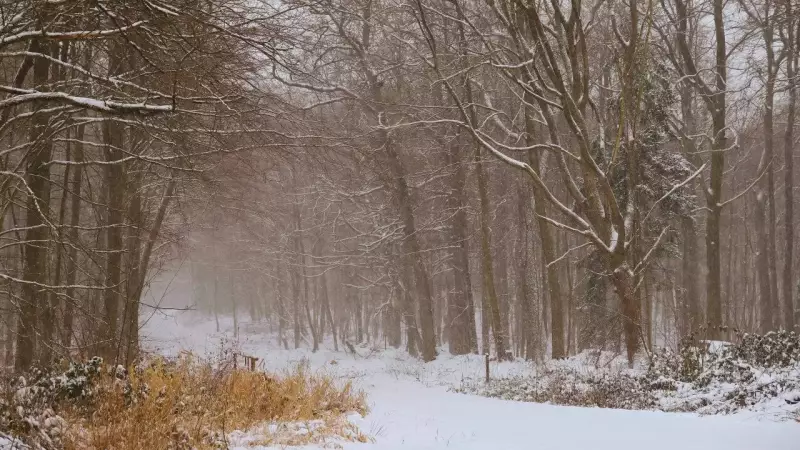
Himachal Pradesh will remain one of the most affected states during this period. Besides heavy snowfall in higher altitudes, isolated heavy rainfall is also likely on January 23. In Uttarakhand, thunderstorm activity accompanied by lightning is forecast on January 23. This raises concerns about travel disruptions in hill districts.
By January 25, precipitation intensity over the western Himalayan region will decrease. Scattered activity may still persist. The outlook for the subsequent three days beyond January 25 suggests unsettled weather may continue.
Rain Spreads into the Plains
As western disturbances progress eastward, rainfall will spread into the northwestern and northern plains.
- Punjab will likely receive scattered to fairly widespread light to moderate rainfall from January 22 to 25.
- Haryana, Chandigarh and west Uttar Pradesh will witness isolated to scattered rainfall during the same period.
- East Uttar Pradesh may see rainfall on January 23 and 24.
- Rajasthan will likely receive light to moderate rain on January 22 and 23.
For Delhi and the adjoining Haryana–Chandigarh subdivision, dry weather is forecast on January 20 and 21. Scattered rainfall will follow on January 22 and 24. Rainfall will become fairly widespread on January 23 before tapering off to isolated activity on January 25. The intermittent rain spell will bring temporary relief from persistent dry conditions. It may also disrupt road and rail traffic during peak hours.
Thunderstorms, Lightning and Gusty Winds Expected
Thunderstorm activity will accompany the rain and snow across several regions.
- On January 22 and 23, thunderstorms accompanied by lightning and gusty winds with speeds of 30 to 40 kilometres per hour are likely at isolated places over Punjab, Haryana, Chandigarh, Uttar Pradesh and Rajasthan.
- Thunderstorms accompanied by lightning are also likely over Himachal Pradesh on January 22 and 23 and over Uttarakhand on January 23.
- On January 24, thunderstorm activity will continue at isolated places over Haryana, Chandigarh and Delhi, Punjab and Uttarakhand.
- By January 25, thunderstorms with lightning are likely mainly over Uttarakhand.
In addition to inland weather, squally conditions are forecast over the southwest Bay of Bengal on January 23. Wind speeds will reach 35 to 45 kilometres per hour, gusting up to 55 kilometres per hour. This could affect marine operations in the region.
Dense Fog and Cold Conditions to Linger
Dense fog will remain a major concern during the early part of the forecast period.

- Dense to very dense fog is very likely during morning and night hours in isolated pockets over Punjab till January 20, with dense fog continuing on January 21.
- Similar conditions are likely over Haryana, Chandigarh and Delhi till January 21, and over Uttar Pradesh till January 20.
- Bihar will also experience dense fog in isolated pockets till January 21.
For Delhi, dense fog is very likely at isolated places on January 20 and 21. This may affect road, rail and air travel during morning and late-night hours. Visibility reductions could lead to delays at the Indira Gandhi International Airport. Slow-moving traffic may occur on major arterial roads.
Cold wave conditions are very likely at isolated places over Himachal Pradesh on January 20 and 21. No cold wave has been forecast for Delhi. However, cold and damp conditions associated with fog and rainfall may enhance the chill factor. This will be particularly noticeable during early mornings and evenings.
The extended outlook suggests unsettled conditions may persist beyond the current forecast window. Scattered to fairly widespread rainfall and snowfall is likely over the Western Himalayan Region, Punjab, Haryana and Delhi during the three days following January 25. Isolated to scattered rainfall activity is expected over west Uttar Pradesh. Isolated rainfall is likely over Lakshadweep and the Nicobar Islands.
Advisory for Public Safety
Authorities urge residents and travellers to remain alert and follow advisories closely.
- Dense fog may disrupt transport and aviation services.
- Thunderstorms and gusty winds could pose risks to outdoor activities and weak structures.
- People should drive cautiously using fog lights, check travel schedules, and avoid unnecessary travel during peak fog and thunderstorm hours.
In the hills, heavy snowfall may lead to temporary closure of mountain passes and landslide-prone routes. Tourists heading to Himachal Pradesh, Jammu and Kashmir, and Uttarakhand should monitor local weather updates. They should avoid high-altitude travel during periods of heavy snow.