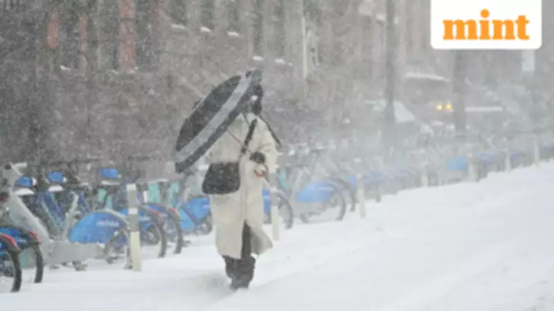
New York City is bracing for another significant winter weather event as meteorologists warn of an approaching snow spell that will bring frigid temperatures and blustery conditions to the metropolitan area. According to weather experts, residents should prepare for a return to bitterly cold weather following a brief period of milder conditions.
Forecast Details for New York City
AccuWeather meteorologist Bob Larson has provided specific details about the impending weather system affecting New York. The next chance of snow accumulation is expected to arrive on Friday night, beginning either late Friday afternoon or early Friday evening. This weather event is attributed to a fast-moving clipper system that is likely to move off the East Coast, bringing precipitation and dropping temperatures significantly.
Temperature and Wind Predictions
Forecasters anticipate particularly challenging conditions for New York residents. On Friday night, temperatures are expected to plummet to a chilly low of 21 degrees Fahrenheit. The situation will deteriorate further on Saturday evening as temperatures drop sharply, accompanied by winds ranging from 15 to 30 miles per hour. These wind conditions will create real-feel temperatures in the single digits, making outdoor exposure potentially dangerous.

Larson emphasized the wind component of this weather system, stating, "Winds will increase as this is coming through and become very gusty. And after this clipper goes by, it will be windy and terribly cold again this weekend." This combination of low temperatures and high winds creates what meteorologists refer to as a wind chill effect, where the air feels significantly colder than the actual thermometer reading.
Extended Forecast Through the Weekend
The challenging weather conditions are expected to persist throughout the weekend, with Sunday offering little relief from the cold. Forecasters predict winds of 10 to 20 miles per hour on Sunday, with temperatures potentially reaching as high as 20 degrees Fahrenheit. However, the wind chill factor may make it feel even colder than the actual temperature reading.
Regional Weather Impact
While New York City prepares for its own winter challenges, the weather system is affecting a broader geographical area. The same storm system is expected to bring half an inch to two inches of snow overnight on Tuesday in parts of the Ohio River Valley, including Cincinnati and northern Kentucky. The precipitation may extend into West Virginia and central Virginia as well.
Meteorologists have identified another storm system following a similar path that will impact southern regions from Roanoke, Virginia, into the very northern parts of North Carolina. This secondary system could dump one to three inches of snow in those areas, creating travel challenges and winter weather concerns across multiple states.
Preparation and Safety Recommendations
Weather authorities recommend that residents take necessary precautions as this winter weather approaches:
- Prepare for potentially hazardous travel conditions due to snow accumulation and reduced visibility
- Dress in layers with appropriate winter clothing to protect against wind chill
- Limit outdoor exposure during the coldest periods, especially when wind speeds are highest
- Check on vulnerable community members who may be particularly affected by extreme cold
- Monitor updated weather forecasts as conditions may change rapidly
The return to winter conditions serves as a reminder that despite brief periods of milder weather, the season still has significant cold spells in store for the Northeast region. Residents are advised to stay informed about developing weather patterns and take appropriate measures to ensure safety during this latest winter weather event.