Millions Brace for Devastating Ice Storm Across United States
Millions of Americans are preparing for a potentially catastrophic ice storm that could wreak havoc from New Mexico to the Carolinas. Forecasters warn this severe weather event threatens to down trees, snap power lines, and leave communities without electricity for days, creating dangerous conditions across a vast swath of the country.
Major Cities Face Snowfall and Travel Nightmares
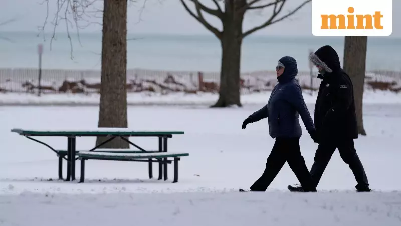
Meanwhile, major metropolitan areas including Washington, DC, Philadelphia, New York City, and Boston are bracing for significant snowfall that could make travel extremely hazardous or nearly impossible. According to AP reports, forecasters have issued urgent warnings about the impending storm system that could paralyze transportation networks in these densely populated regions.
Forecast Details and Temperature Plummets
Brian Hurley, a meteorologist with the National Weather Service's Weather Prediction Center in College Park, Maryland, provided detailed forecasts to Reuters. He indicated that 4 to 10 inches (10 to 25 cm) of heavy, wet snow was expected to begin falling Saturday, with temperatures dropping into the low 20s Fahrenheit (minus 5.5 C) in Washington, D.C. Boston faces even more extreme conditions, with overnight lows forecast near 7 degrees Fahrenheit (minus 14 C).
Widespread Winter Alerts Cover Nearly Half of US Population
The National Weather Service confirmed Thursday afternoon that approximately 160 million people, representing nearly half of the US population, were under various winter storm watches, warnings, and advisories. These alerts span an enormous geographical area, reaching from Arizona and Montana in the West to the Carolinas and Maine in the East.
Storm Timeline and Atmospheric Conditions
The dangerous storm system is forecast to begin Friday and persist through the weekend, bringing heavy snow and a dangerous mix of winter precipitation including freezing rain and sleet. Meteorologists note that an atmospheric river of moisture could establish itself by the weekend, spreading precipitation across Texas and other Gulf Coast states before moving through Georgia and the Carolinas and tracking farther northeast.
East Coast Forecasters Predict Major Impacts
Weather service forecasters on the East Coast, who express increasing confidence that the storm will strike major cities, have stated that "snow amounts could reach a foot or more in the I-95 major cities from D.C. to Boston." Forecasters at the NWS office serving Washington and Baltimore issued particularly dire warnings, noting that the region could face serious dangers as heavy snow and ice combine with extended, bitterly cold temperatures, creating major threats to both life and property across nearly the entire area.
Emergency Measures and State Responses
As the storm approached, New York state remained under a "Code Blue" emergency declaration, a measure that requires social service agencies to extend shelter hours and ensure homeless residents can access safe, warm spaces. Chicago was forecast to plunge into a deep freeze, with temperatures dropping to 2 degrees below zero Fahrenheit on Friday and Saturday, accompanied by dangerous wind chills near 30 below zero (minus 34 C).
In Texas, Governor Greg Abbott took decisive action by issuing a state of emergency. His administration mobilized additional personnel and equipment to assist with traffic management, monitor power outages, and carry out rescues for people affected by the storm. Governor Abbott encouraged residents to stay alert and take precautions, urging Texans to "remain weather-aware, check DriveTexas.org before traveling, and heed the guidance of state and local officials."
Storm Departure and Lingering Cold
Forecasters indicate the system should move out of most areas by late Sunday or early Monday, but intense cold will linger well after the precipitation ends. An Arctic blast moving south from Canada could maintain extremely low temperatures, with Fargo, North Dakota expected to see a high of just 5 degrees below zero on Saturday, demonstrating the widespread nature of this cold air mass.


