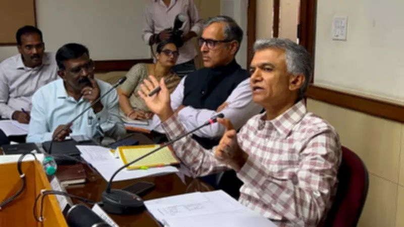
GIS Dashboard to Curb Rampant Road-Digging Across Bengaluru
The Greater Bengaluru Authority (GBA) has launched a new GIS-based dashboard to monitor and regulate indiscriminate road-digging across the city. The platform will also enable citizens to report civic issues such as potholes and track the progress of corrective action.
Announced on 3 July 2026, the dashboard aims to bring transparency and coordination among various agencies responsible for digging roads for utility works, including water, electricity, and telecom cables. According to GBA officials, the system will provide real-time data on digging permits, ongoing projects, and restoration status.
How the Dashboard Works
The GIS dashboard integrates data from multiple civic bodies and utility providers. It displays a city map with color-coded markers indicating active digging sites, completed works, and pending restoration. Citizens can access the dashboard via a web portal or mobile app to view planned and ongoing excavations in their area.

Each digging project will be assigned a unique ID, and agencies must update the status regularly. Failure to restore roads within the stipulated timeframe will result in penalties. The system also uses satellite imagery and ground-level sensors to verify compliance.
Citizen Reporting Features
Residents can report potholes, uneven surfaces, or incomplete restoration through the dashboard. The complaint will be automatically routed to the concerned agency, and the complainant can track the resolution progress. This feature aims to reduce the time taken to address civic issues.
According to a GBA spokesperson, “The dashboard empowers citizens to hold agencies accountable. It will reduce the chaos caused by uncoordinated digging and ensure roads are restored promptly.”
Impact on Bengaluru’s Infrastructure
Bengaluru has long struggled with frequent road-digging for utility maintenance, leading to traffic congestion and safety hazards. The GBA estimates that over 50,000 digging permits are issued annually, but restoration often lags. The new system is expected to cut restoration delays by at least 30% within the first year.
The dashboard will also help agencies coordinate their work, reducing the number of times a road is dug up repeatedly. This integrated approach is part of the city’s broader smart city initiatives.