The Indian Meteorological Department has sounded the highest alarm as Severe Cyclonic Storm 'Mocha' intensifies over the Bay of Bengal, charting a dangerous course toward the Andhra Pradesh coastline. The weather system is expected to make landfall within hours, bringing catastrophic conditions to coastal communities.
Impending Landfall and Maximum Impact Zones
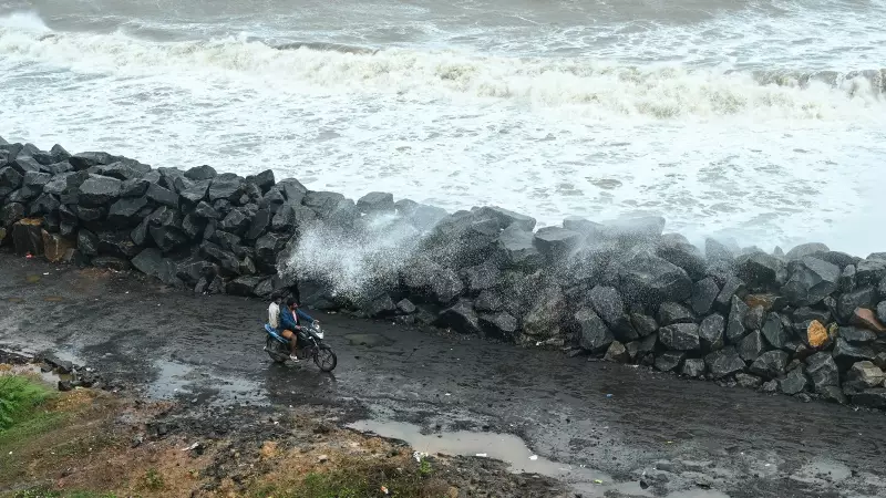
According to the latest IMD bulletin, Cyclone Mocha is positioned approximately 200 km southeast of Kakinada and 140 km east of Narsapur. The storm system is packing sustained wind speeds of 90-100 km/h, gusting up to 110 km/h, as it moves northwestward at 12 km/h.
The most severe impact is anticipated in:

- Kakinada district
- Konaseema region
- Eluru district
- West Godavari areas
Extreme Weather Conditions Forecast
The IMD has predicted exceptionally heavy rainfall exceeding 20 cm in isolated areas of coastal Andhra Pradesh districts on Tuesday and Wednesday. The combination of torrential rains and storm surges poses a significant threat to low-lying coastal regions.
Fishermen have been strictly warned against venturing into the sea, with current sea conditions described as 'very rough to high' across the northwest Bay of Bengal. Coastal areas are already experiencing strong gales and increasing wave activity.
Emergency Response and Preparedness Measures
State disaster response forces have been put on high alert across vulnerable districts. Emergency operations centers are monitoring the situation round-the-clock, coordinating evacuation efforts in high-risk zones.
Key preparedness actions include:
- Activation of emergency shelters in coastal communities
- Deployment of National Disaster Response Force teams
- Coordination with coastal security agencies
- Stockpiling of essential supplies and medical resources
Regional Impact and Extended Forecast
While Andhra Pradesh bears the brunt of the cyclonic fury, neighboring states including Odisha and Tamil Nadu are also experiencing peripheral effects. The IMD has issued heavy rainfall warnings for these regions as the storm system influences broader weather patterns.
Authorities emphasize that residents in the predicted path should remain indoors, secure loose objects around their properties, and follow official updates through designated channels. The cyclone's intensity and trajectory continue to be monitored through Doppler weather radars and satellite systems.
This severe weather event underscores the increasing frequency of intense cyclonic systems in the Bay of Bengal region, highlighting the critical importance of robust early warning systems and disaster preparedness protocols.